Follow Us
Published March 12th, 2024
Change colors, outlines, sizes, and much more with the new map icon experience in MapTiler Customize. We have also included over 200 new icons into...
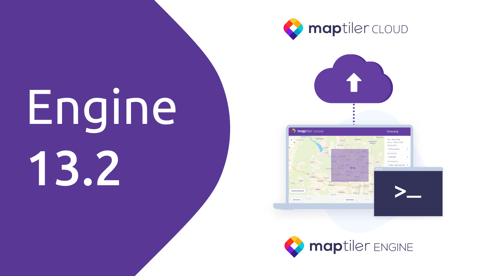
Published February 27th, 2024
MapTiler Engine 13.2 is out! Get ready for exciting new features that make it much easier to interact with the MapTiler platform and communicate with our team. Key...
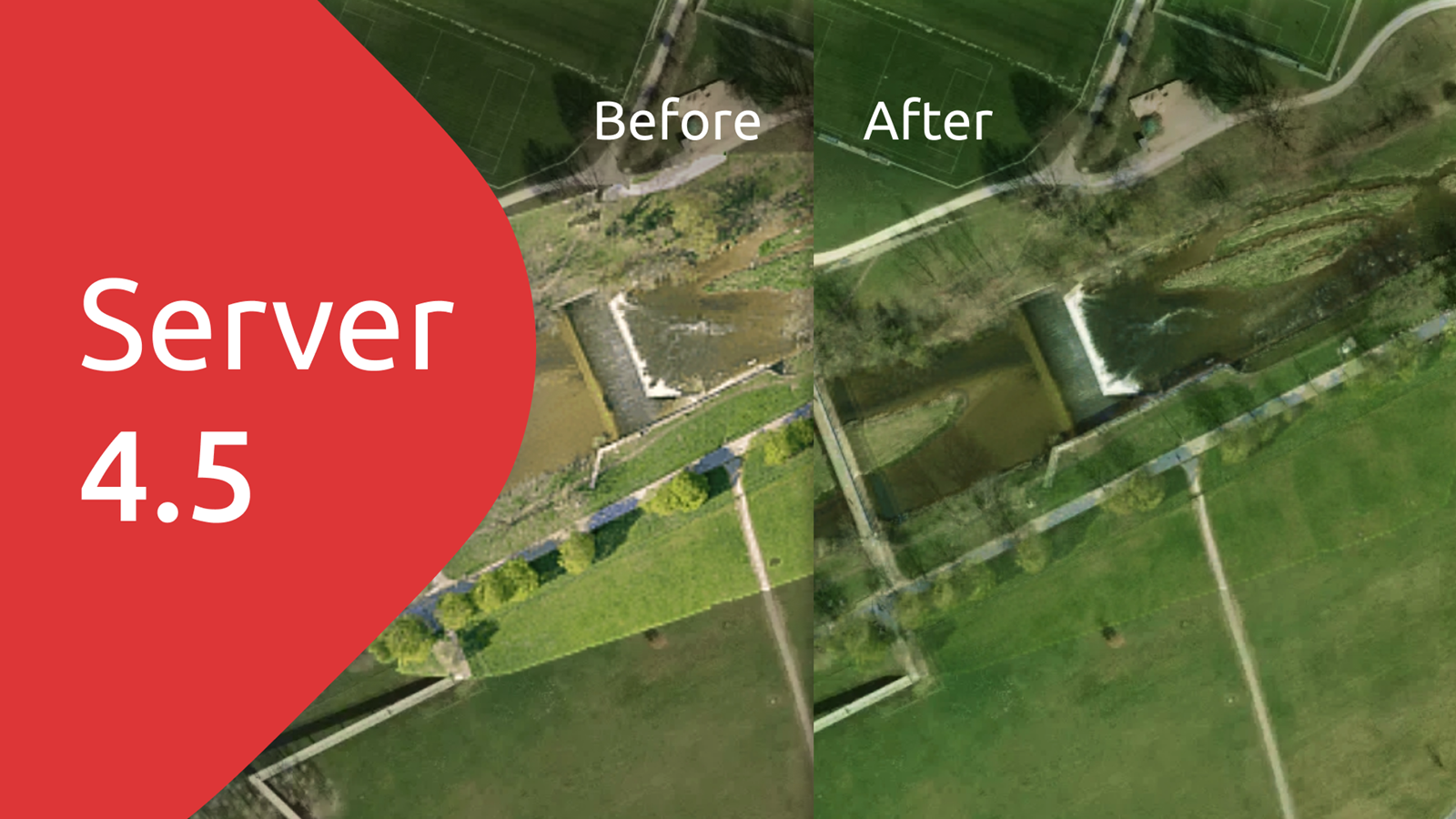
Published February 14th, 2024
MapTiler Server 4.5 is out, and you can now benefit from: Blending imagery from different datasets into one layer Updated compatibility with different Operating Systems ...
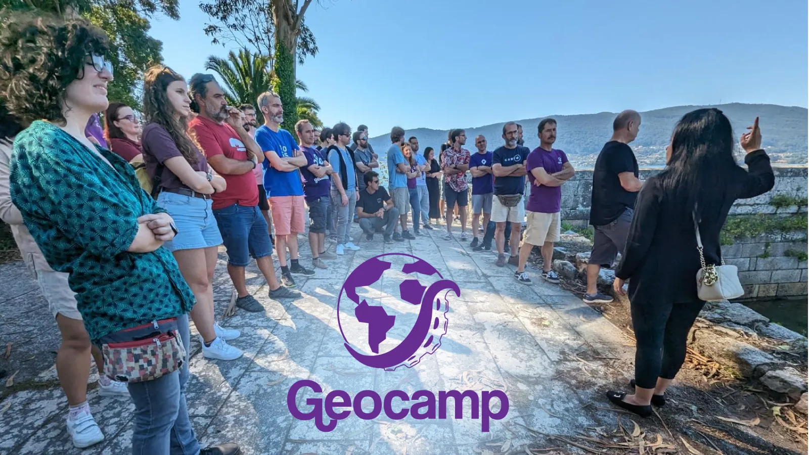
Published December 4th, 2023
Geocamp ES is a non-profit, free-to-attend, and self-financed national event. Organized by the international collective Geoinquietos , it brings together communities made up of informal groups...
Published November 22nd, 2023
We are thrilled to unveil the new MapTiler Engine 13, providing a much faster and more efficient map tiling experience. This release focuses on performance, ease of use, and...
Published October 31st, 2023
A high-resolution satellite map of the entire world is now available to all free and paying users of MapTiler Cloud. The stunning map layer from Maxar is a seamless...
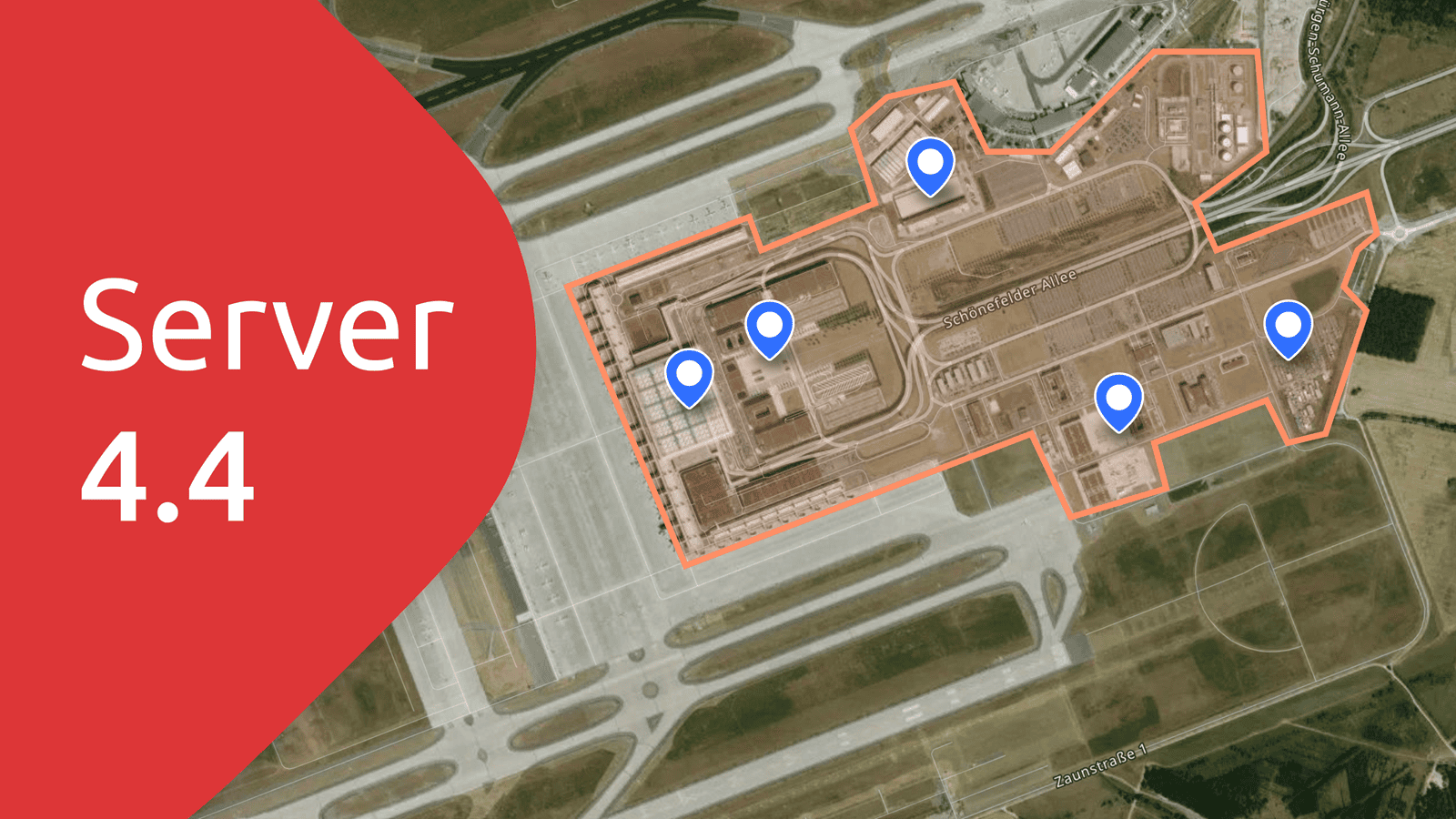
Published October 11th, 2023
We have a raft of improvements in our software for hosting your own map tiles. Highlights of MapTiler Server 4.4 include: Personalize static maps with markers...
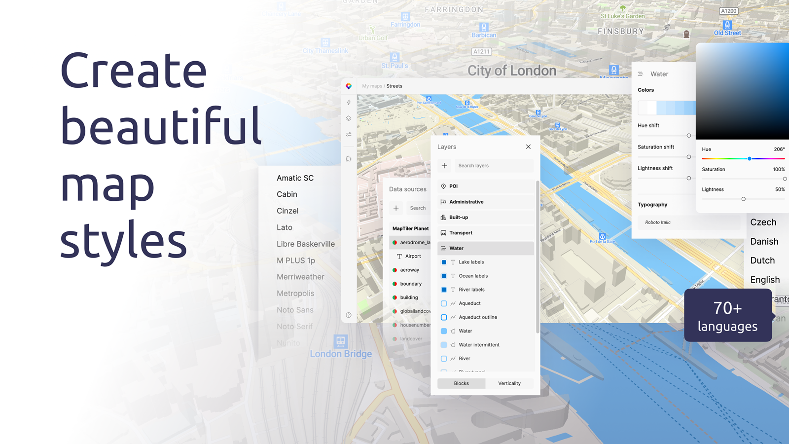
Published August 28th, 2023
Now everyone can create beautiful maps with our new customization tool: Quick edits to language, fonts, and colors let you update the map fast Advanced cartographical...
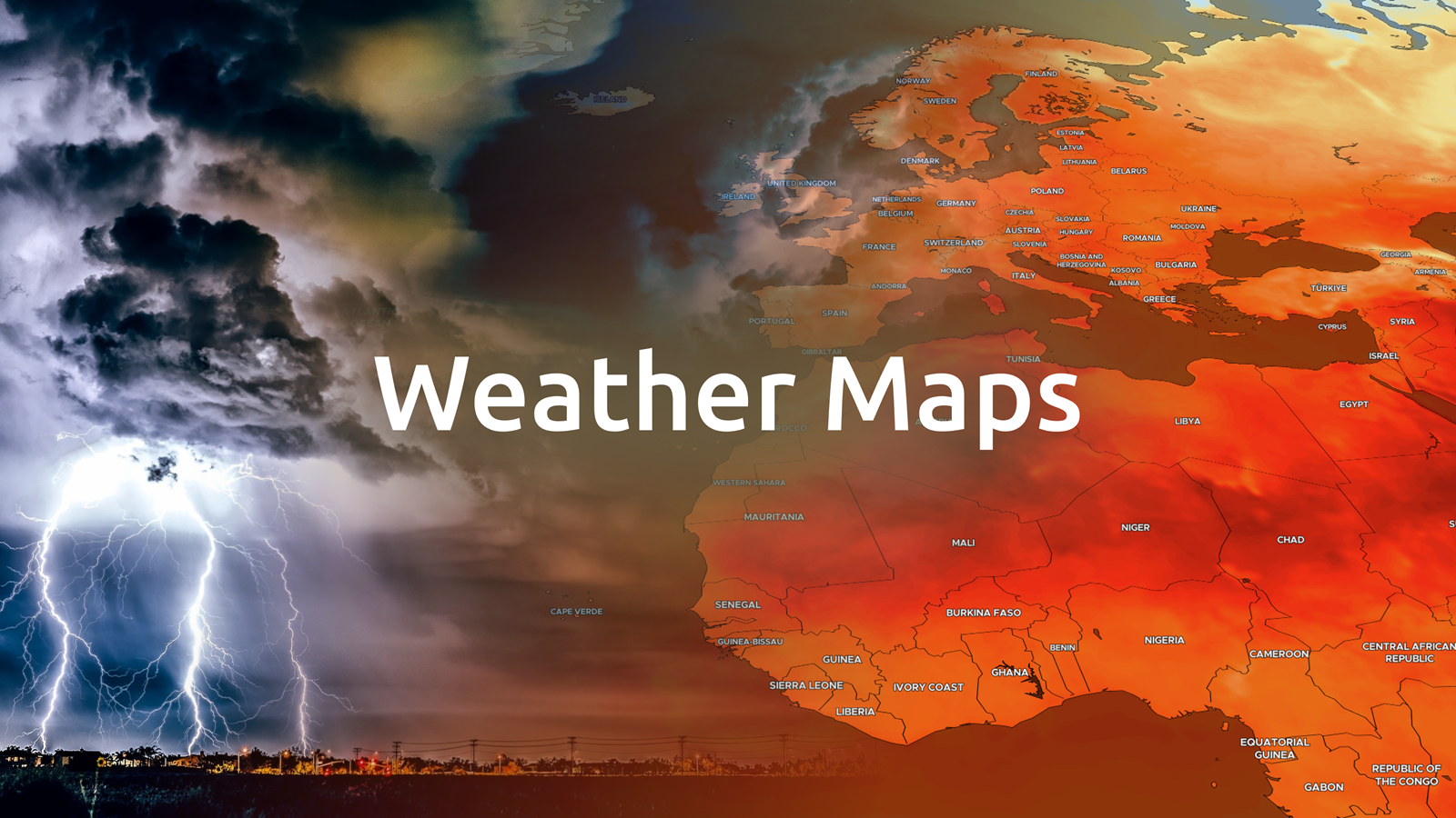
Published July 24th, 2023
MapTiler is launching new weather layers in MapTiler Cloud and a MapTiler SDK module to visualize weather forecasts (or other raster time series data) like never before! ...
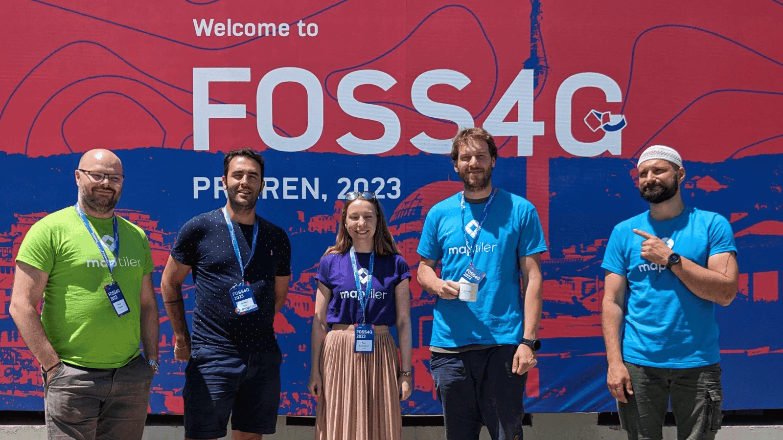
Published July 2nd, 2023
At MapTiler, we believe in open-source projects and actively contribute to several key ones in the geospatial industry. This means we are always keen to participate in...
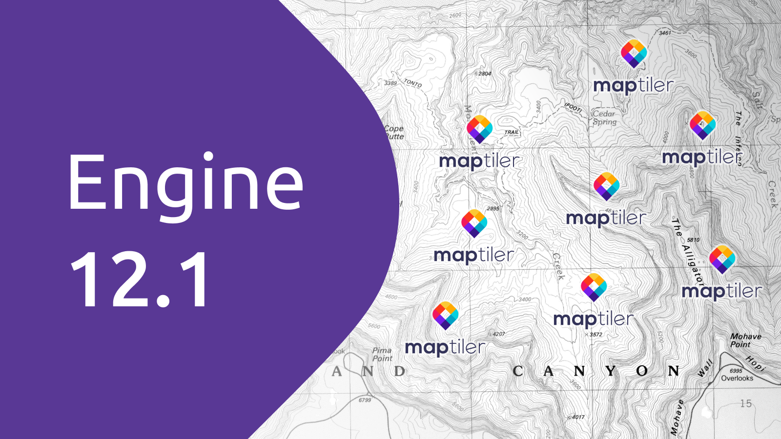
Published May 30th, 2023
Introducing MapTiler Engine 12.1 We have released a new version of our ultimate map tiling software. MapTiler Engine 12.1 can now: be used in any...
Published May 29th, 2023
The Swiss Economic Award is a prestigious prize that recognizes exceptional entrepreneurial accomplishments in Switzerland. More than 120 companies applied for this prize in 2023. The selection...
Published May 23rd, 2023
OpenMapTiles has been updated bringing a raft of improvements to enable you to make better maps: New OpenStreetMap inspired map style Natural Earth 5 data...