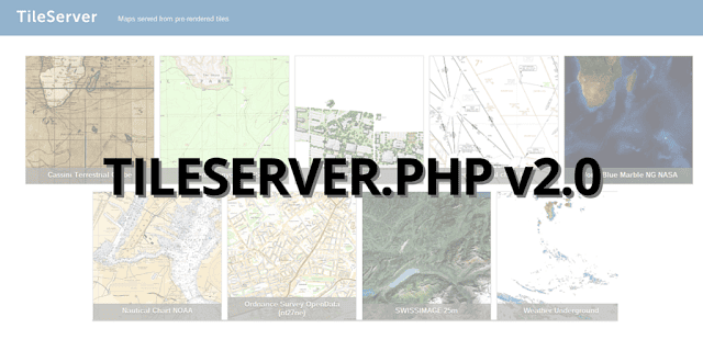
New version of the open-source project TileServer-PHP has just been released and is available at https://github.com/klokantech/tileserver-php
The project distributes maps to desktop, web, and mobile applications from a standard Apache+PHP web hosting. It implements OGC WMTS standard for pre-rendered map tiles made with MapTiler or available as MBTiles files.
The new features include:
MapBox Studio Classic vector tiles supported
Hosting of vector tiles in MBTiles format generated by MapBox Studio Classic is possible on a custom server with TileServer-PHP. Users can also download ready-to-use OpenStreetMap vector tiles from http://osm2vectortiles.org/downloads/ and style them with MapBox Studio Classic!
TileServer-PHP can serve the vector tiles to OpenLayers, MapBox GL JS and native Android or iOS apps.
Custom designed templates
To change look&feel of the TileServer-PHP frontpage with your own design, branding, and functionality see https://github.com/klokantech/tileserver-php/wiki/Template
WMTS for tiles in any coordinate system
MapTiler can generate tiles in a custom map projection or country specific coordinate systems (such as UK’s Ordnance Survey EPSG:27700 or Swiss CH1903 / LV03 EPSG:21781). TileServer-PHP now serves these tiles to any GIS software via OGC WMTS standard. Draft of an extension of TileJSON with support for custom projections is at https://github.com/klokantech/tilejson-spec/tree/custom-projection/2.2.0
Hybrid and WebP map tiles
Hybrid tiles (JPG+PNG) where partly transparent tiles can be combined with opaque ones in one layer are supported. This solution and new WebP format are mostly used on satellite imagery to reduce the size.
TileJSON and WMTS for remote tiles
Serving WMTS or TileJSON for remote tiles hosted on Amazon S3 or Google Cloud Storage. As an online service already runs on http://wmts.maptiler.com/. Upload is quick and easy with MapTiler: http://www.maptiler.com/how-to/hosting-on-amazon-s3/rid tiles (JPG+PNG) where partly transparent tiles can be combined with opaque ones in one layer are supported. This solution and new WebP format are mostly used on satellite imagery to reduce the size.