High-resolution coverage of the entire France
We are glad to announce that the whole French open imagery is now included in the MapTiler Satellite basemap. Ready-to-use from our cloud infrastructure using MapTiler Maps API, we’re now also offering this imagery for self-hosting with MapTiler Server.
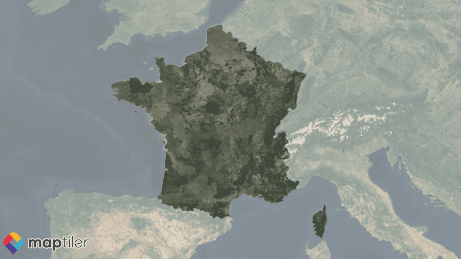
High-res aerial images of the entire France were tiled, color-toned, and seamlessly integrated into the MapTiler global satellite map.
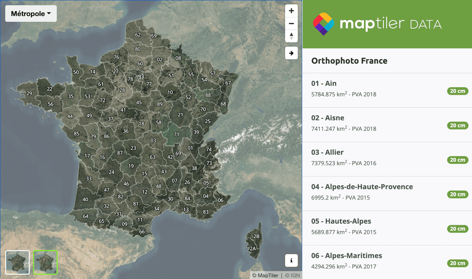
More than half a million square kilometers of 20cm/px resolution aerial imagery has been processed and deployed to MapTiler Cloud, now available to all our users. One hundred départements available from the French government were tiled, color-toned, and seamlessly integrated into MapTiler Satellite over the last year. The recent open data release by IGN (Institut Géographique National) allowed us to complete the processing over the full territory.
This new update perfectly complements the high-resolution aerial imagery already available in other countries, including the USA, Japan, and most of the countries in Western Europe.
Reliable satellite basemap via MapTiler Maps API
Our Satellite map now features the most recent high-resolution IGN orthophoto and can be accessed with a free MapTiler Cloud account, ready to use in your web, mobile, or desktop applications. Subscribe to one of our paid plans for integration with your product or business. Take advantage of our Cloud infrastructure and rely on always up and fast satellite map services. MapTiler Satellite is available through TileJSON, XYZ, or WMTS endpoints for quick integration in mapping applications and various software such as QGIS or ArcGIS.
On-premise imagery with MapTiler Server
The same high-resolution aerial imagery is now also available for self-hosting with MapTiler Server! That lets you deploy the French orthophoto on your infrastructure or to a private third-party organization very quickly and use it in production for secured web maps, critical embedded systems, or even offline mobile apps. Orthophoto France is available upon request and includes a MapTiler Server license subscription.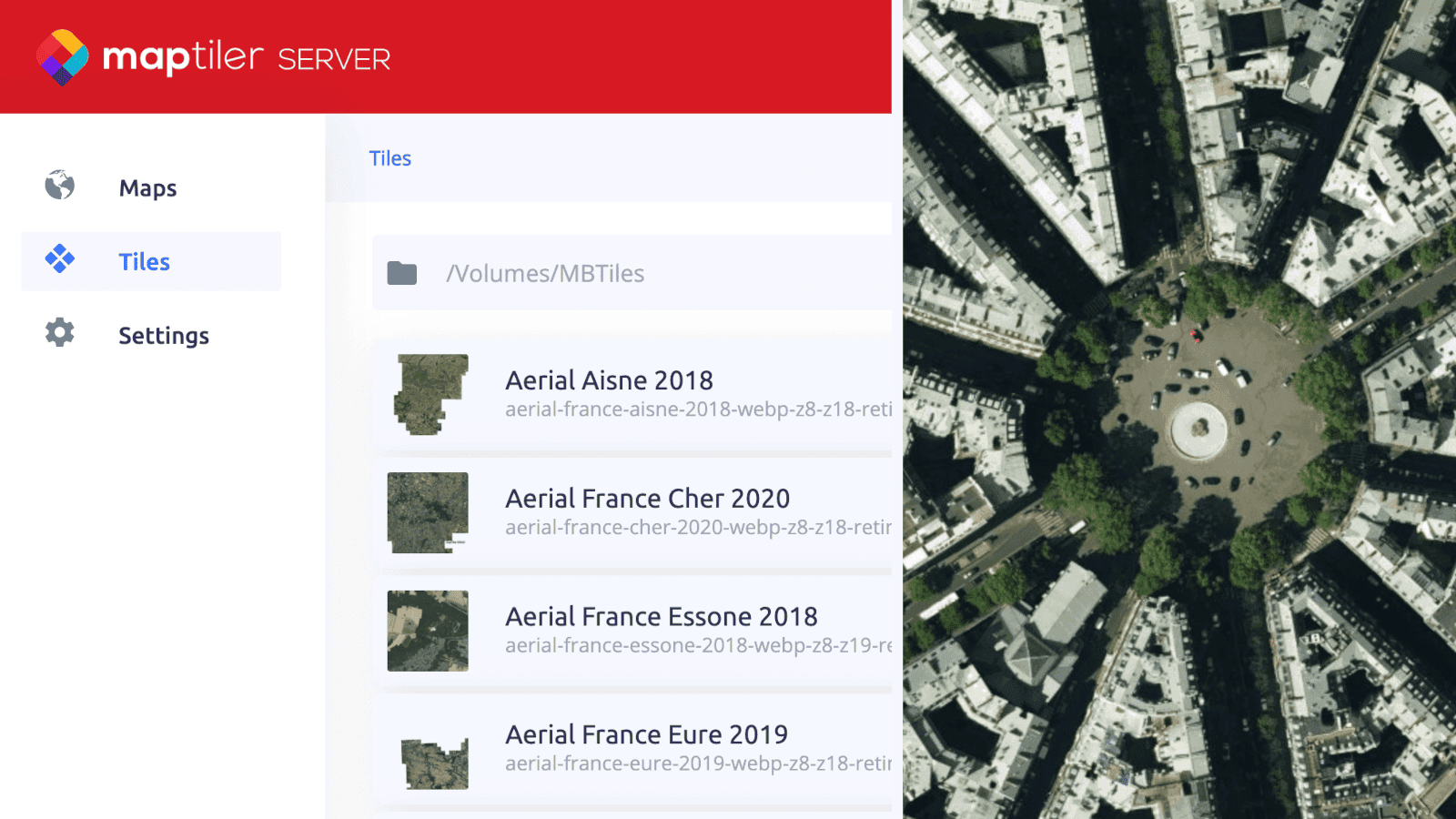
Get the most of the local MapTiler Data
Use the French high-resolution imagery directly from MapTiler Cloud or locally with MapTiler Server according to your specific needs. Feel free to contact our local expert with any questions or sales requests.