OpenMapTiles has been updated bringing a raft of improvements to enable you to make better maps:
- New OpenStreetMap inspired map style
- Natural Earth 5 data in basemaps
- Improved land use and land cover polygons information on zoomed-out maps
- PostgreSQL 14 compatibility
If you want to get started with OpenMapTiles then MapTiler provides cloud and self-hosting solutions:
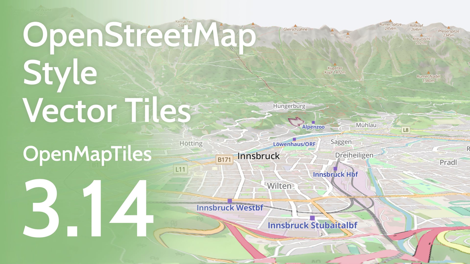
OpenStreetMap inspired vector tiles as an OpenMapTiles style
OpenMapTiles is now available with a new style that shows all the features. Inspired by OpenStreetMap Carto, this style is a cartographic design you are familiar with for a vector dataset you can use at all zoom levels. This new cartographic style is bound to the schema, meaning you can now see any additions or improvements as and when they are made. This does mean that any pull requests to update the schema also require a modification to the style.
We have proposed that this style is featured on osm.org as the best way to represent OpenStreetMap data on vector maps. The benefits of this would be:
- Multi-language maps, with language switching easily implemented.
- Compatibility with 3D Mapping, with labels and features that don’t warp badly when added to the terrain.
- The ability to see the changes you make on your local machine while you edit the schema (Using TileServer and the tools included)
We hope to see the style adopted by the OpenStreetMap Foundation soon!
Natural Earth 5 data
We’ve improved the OpenMapTiles base data of the more zoomed-out maps with Natural Earth 5 to give the latest information, including:
- New and improved county and state borders inside individual countries.
- Updated placenames in multiple languages so you can create maps for specific audiences.
- New and updated attributes, such as Wikidata IDs to link to other datasets
Better Landuse & Landcover data
Polygon areas, such as natural and urban areas, are now much better represented on medium-scale maps. You now get to see more forests, natural areas, and even residential areas at these scales as smaller polygons are shown at more zoomed-out levels. The result is a much more accurate picture of the extent of forestation or urbanization when getting an overview of an area.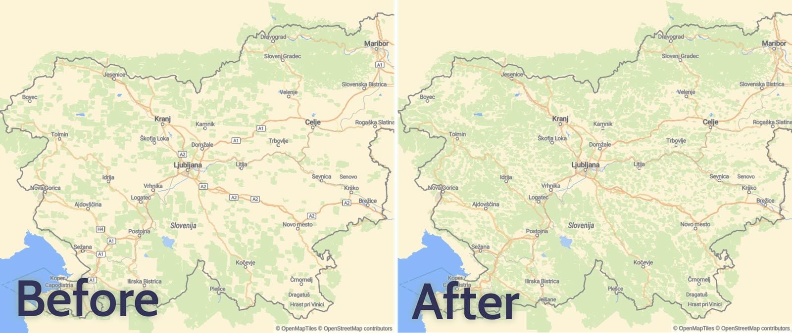
Postgres 14 compatible data for your maps
The latest version of OpenMapTiles is the first to be generated with the OpenMapTiles Tools 7.0. This means the data is now compatible with PostgreSQL 14, so you can take advantage of more up-to-date software.
Extra features
Finally, we’ve added some extra features to OpenMapTiles. You can now find the following additional features from version 3.14 on the maps:
- Parcel locker
- Shrubbery
- Bus guideway
- Quarry
 Because all new features added to OpenMapTiles need to have a style, these extras can already be seen in OSM OpenMapTiles maps. This also means that any future additional features will also be visible in this style from the moment they are added!
We hope that this will drive more contributions to this amazing dataset.
You can find a complete list of changes in the GitHub release notes here: Release v3.14.
Remember, you can use map hosting from the authors of this open-source project to serve both raster and vector tiles. Through MapTiler cloud you can design a custom map style fitting your app with a few clicks, and MapTiler has the lowest hosting costs, cheaper than maintaining your own map servers.