Self-hosting maps often means balancing high-quality data needs with storage infrastructure and flexibility. While our users have long enjoyed the ability to download specific regional extracts for datasets such as OpenStreetMap vector tiles, accessing medium-resolution satellite imagery previously required downloading the entire global dataset (over 500 GB).
We are excited to announce that regional extracts are now available for Satellite Medium resolution imagery.
With on-premises Standard or Custom subscriptions, you no longer need to download the whole planet if your project is focused on a specific area. You can now select any region of your choice: from entire continents and countries down to major cities.
Key Benefits:
- Optimized storage: Significantly reduce the disk space required for your on-premises setup.
- Faster setup: Download only the data you need.
- Flexibility: Deploy quickly to target devices or hosts.
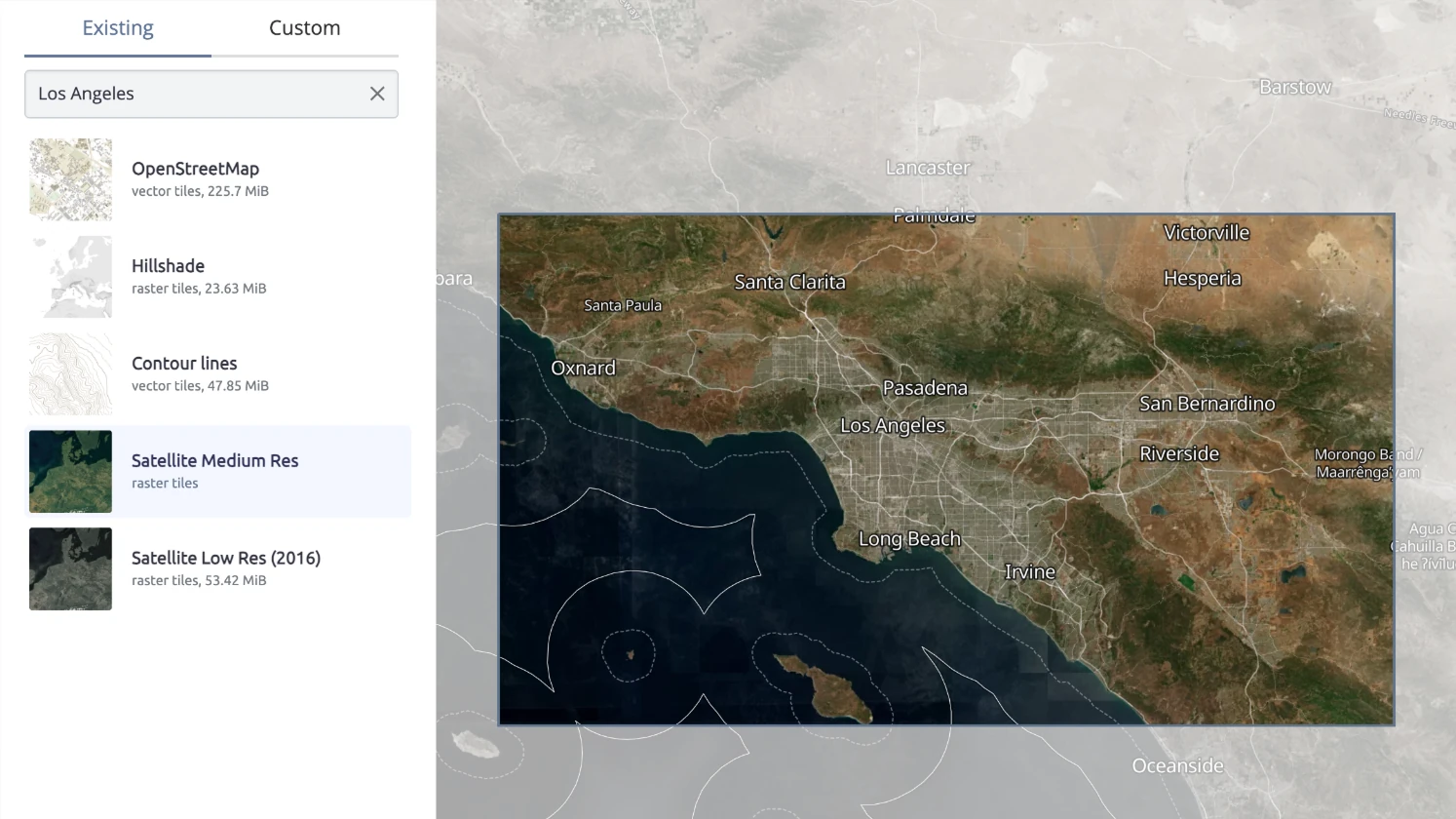
This feature is available right now in the "New Dataset" dialog of the Data downloads dashboard. Simply search for your location (e.g., "Los Angeles"), select Satellite Medium Res, and the system will prepare the specific extract for your server.