
Weather
Perfect maps for weather visualization
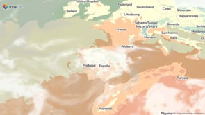
Ideal base maps for weather
Display any weather-related information as an overlay on top of our base maps.
Use our Cloud base maps as a background to show:
- cloud coverage
- air quality
- wind direction and speed
- rainfalls
- CO₂ concentrations, and more
Avalable both online and on-prem.
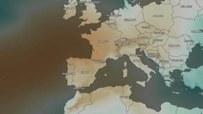
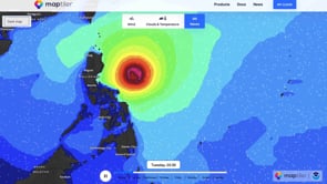
Interactive forecast maps
Display animated weather forecast data on maps. The MapTiler Weather Module comes with 5-day forecast layers for:
- temperature
- wind
- radar
- rain and snow
- cloud cover
- pressure
Use your own weather data in 3D and other enhanced mapping tools with our Weather Plus service.
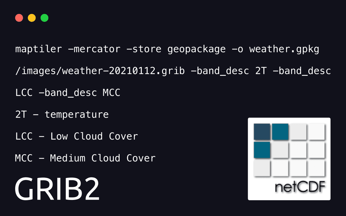
Processing weather data
Some of the world's most significant mapping and meteorological agencies such as NOAA and National Center of Meteorology UAE trust MapTiler to process their geodata and the aerial imagery into beautiful interactive weather maps.
You too can create smooth zoomable meteorological maps with the full power of Engine.
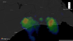
Display 3D radar data on a map
Explore animated weather data visualizations like clouds’ movements, density and exact real-time location.
Inspect meteorological developments with customizable cutting tool - strip off the layer and analyze clouds' composition for better precipitation.
View current and future weather changes over time in an interactive 3D interface with integrated timeline, fully optimized for both web browsers and touch devices.
Visualize gridded data
Display weather visualizations of gridded data like temperature and humidity.
Animated particles dynamically change direction and speed to visualize changes in winds and ocean currents. Enhance intensity values by color-grading and adding a speed.
Process atmospheric data in NetCDF format and display it on top of MapTiler base maps to compose easy to understand maps for your audiences.
Customers success stories
Meteorological Office is the United Kingdom's national weather service. Run by the Department for Business, Energy and Industrial.
read story

The biggest weather forecast portal for Germany, Switzerland and Austria run by ProSieben Sat1 TV group has more than 20 million unique visitors daily.
read story
Surfline started in 1985 by tracking waves on the US West Coast and it is one of the biggest surf forecasting and surf reporting websites worldwide.

Visualization for your weather website
We provide the full stack:
-
5-day forecast for temperature, wind, rain, and more