Customer stories
Met Office Visualizing climate data
The Met Office is the United Kingdom's national weather service. Their expertise lies in meteorological predictions across all timescales, from daily forecasts to climate change.
Clean map design for overlaying weather data
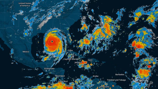
Maps are an integral part of the Met Office experience, covering broad forecasts from wind gust, storm fronts to surface pressure. Data-driven visualizations can be complex, so it is important that relevant information is clearly communicated.
Our Server enables the Met Office to display meteorological information with a plain map design to let their data stand out. Removing unnecessary distractions on the base map helps keep the focus on the critical weather information.

Real-time climate data
Millions of people rely on the MetOffice on a daily basis for accurate maps that deliver more than just forecasts. They let people know if they should take an umbrella, pack the sunglasses, or stay home because of a snowstorm.
Weather information and severe weather warnings are highlighted with beautiful colors and animations.

Maps show only relevant information
Some forecasts are more important than others, such as weather warnings.
Highlighting hazardous weather conditions is a great way to emphasize weather-related threats such as heavy snow, icy roads, or thick fog. This crucial data can enormously help people to get back home safely.

Visualization for your weather website
We provide the full stack:
-
5-day forecast for temperature, wind, rain, and more
Want to make your own weather forecast maps?
Try our technology