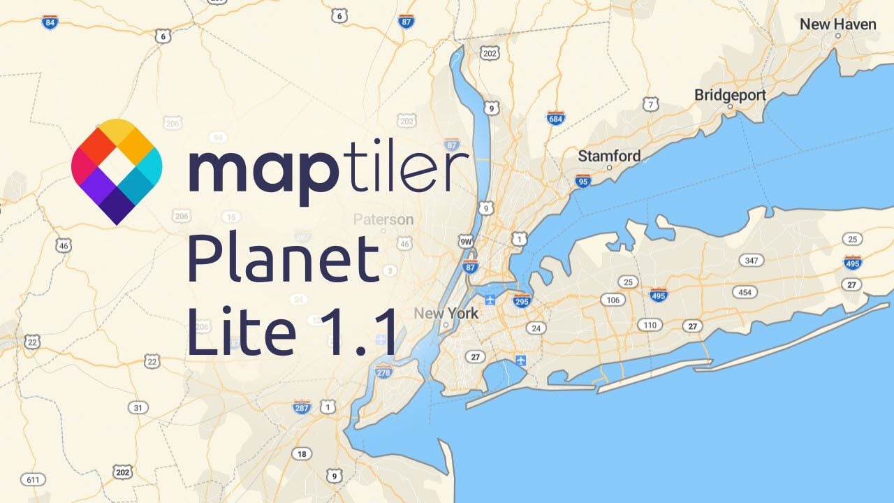
We have updated our basemaps to be our most complete and authoritative map for developers so far.
With the improvements to MapTiler Planet, you have more natural-looking global maps and no longer need to worry about map vandalism. We have combined new datasets with OpenStreetMap, resulting in the addition of over 150 million buildings and authoritative land cover data.
We are also using quality control to ensure the OpenStreetMap data we use has not been vandalized. The latest MapTiler Planet data is our most feature-rich and trustworthy mapping of the entire globe.
Millions of extra buildings
In a giant leap forward we have added over 150 million buildings to MapTiler Planet, making it one of the most complete datasets available. OpenStreetMap is a remarkable resource, but the volunteers adding the data to the map have not reached everywhere yet. Combining the data with other resources has allowed us to fill in the gaps in several countries, including the USA and Canada.
The buildings data is ideal for close-up mapping showing the locations of homes and businesses or for use in 3D maps of cities as many of the buildings have heights too.
Huge cities mapped in 3D: This fly-through of Los Angeles shows that it isn’t just the large buildings in urban centers but all the homes and small businesses in the suburbs and beyond. The buildings from Microsoft have heights, so you can display them in 3D.
Some of the countries that have benefited the most from the additional buildings can be found in the table below:
| OpenMapTiles | MapTiler Planet | Extra buildings | |
|---|---|---|---|
| Argentina | 940,478 | 27,247,549 | 26,307,071 |
| Australia | 2,751,705 | 12,198,751 | 9,447,046 |
| Brazil | 9,100,222 | 116,340,933 | 107,240,711 |
| Canada | 6,352,601 | 13,268,539 | 6,915,938 |
| Germany | 37,220,693 | 42,825,419 | 5,604,726 |
| Great Britain | 13,013,084 | 22,091,398 | 9,078,314 |
| Indonesia | 39,805,929 | 101,919,944 | 62,114,015 |
| India | 12,963,324 | 431,933,620 | 418,970,296 |
| Italy | 14,681,428 | 20,118,280 | 5,436,852 |
| Japan | 20,742,530 | 68,748,109 | 48,005,579 |
| Mexico | 2,767,762 | 65,404,400 | 62,636,638 |
| Malaysia | 1,051,688 | 9,104,932 | 8,053,244 |
| Philippines | 10,342,332 | 29,978,166 | 19,635,834 |
| Poland | 17,233,788 | 22,386,388 | 5,152,600 |
| Russia | 24,235,008 | 70,271,793 | 46,036,785 |
| Thailand | 984,362 | 44,741,203 | 43,756,841 |
| Ukraine | 6,212,703 | 24,961,213 | 18,748,510 |
| USA | 62,577,466 | 152,005,530 | 89,428,064 |
| Venezuela | 382,754 | 10,271,917 | 9,889,163 |
| Total | 590,279,161 | 2,411,240,973 | 1,820,961,812 |
Much of this data has come from Microsoft, whose work with neural networks on aerial imagery allowed them to create building datasets for the USA, Canada, Australia, Tanzania, and Uganda.
In addition to this, through our partnerships in Japan, we secured another buildings dataset with millions of Japanese buildings. With these added to MapTiler Planet, urban areas look more complete than ever before!
Reliable and authoritative
MapTiler has taken the fear out of using maps created from open data by partnering with Facebook. With over 5 million edits a day, OpenStreetMap is a fantastic feat of map making, trusted by many businesses, large and small. However, not all edits are correct, and some are intentionally wrong. The data used in MapTiler Planet undergoes quality control before use to remove any map vandalism, accidental edits, and other inaccuracies.
MapTiler Planet contains quality-assured data, to which we then add our own extra information, providing you with our best mapping ever.
Quality Control in Action: The review process removes the “Bob Was Here” graffiti from the map. There have been much more severe instances of vandalism, but these are no longer of concern to MapTiler Planet users.
Maps that reflect the real world
The world is not just beige and blue, we wanted a map that looked more like the real world when you are more zoomed out. To make this happen, we added new data to the rural and wilderness areas of the world. We created our own bespoke global land cover data to show off Earth’s forests, grasslands, deserts, and glaciers in all their glory.
These beautiful maps are better for showing regions where there might not be any other detail. These areas are simply blank in other map products, leaving a visually unappealing map.
With the global data available in the top 10 most zoomed-out levels, we have sourced official data to make sure the USA and Canada are covered in even more detail as you zoom in. In Europe, we found that the landcover already in OpenStreetMap looked really good so there was no need to source more data.
With the natural and agricultural areas colored based on the vegetation and the urban regions filled with buildings, MapTiler Planet has banished the blank spaces.
MapTiler Planet underpins all our mapping products, meaning you can customize the maps to suit your needs or choose from a range of ready-made styles. Have a look for yourself to see how you can benefit from using our most complete data in your website or apps: