We had three important updates in the last month:
- Fresh aerial imagery for the USA, Denmark, and Finland
- Add Grid lines and time zones to create beautiful atlas-style maps
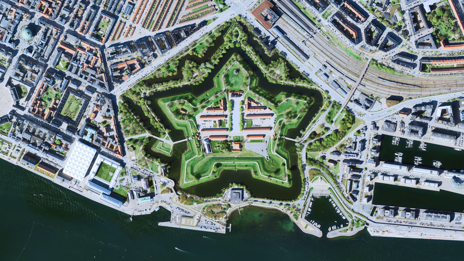
Up-to-date aerial imagery for 5 States in the U.S., Denmark, and Finland
We have fresh imagery for Denmark, Finland, California, Washington, Utah, Nebraska, and Massachusetts as part of our commitment to keeping our satellite layer up to date and high-resolution.
- Denmark now has imagery from 2025 at 12.5cm per pixel
- Finland now has imagery from up to 2025 at 50cm per pixel
- California now has imagery from 2024 at 60cm per pixel
- Washington now has imagery from 2023 at 60cm per pixel
- Utah now has imagery from 2024 at 60cm per pixel
- Nebraska now has imagery from 2024 at 60cm per pixel
- Massachusetts now has imagery from 2024 at 15cm per pixel
Create stunning maps using grid lines
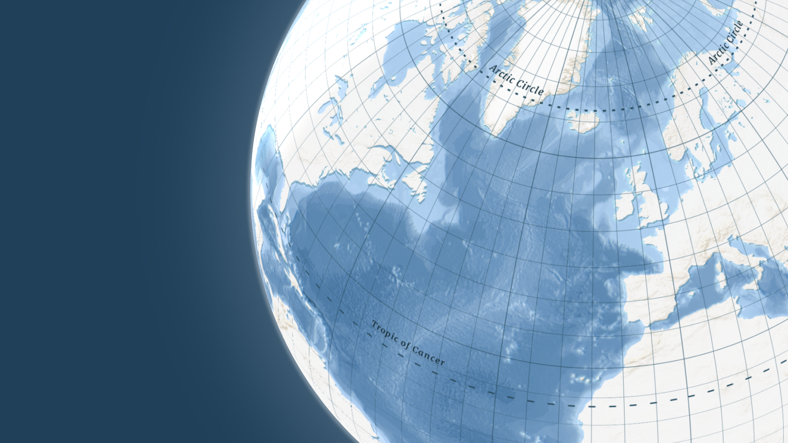
Give your maps quality and authority with our new data layer containing gridlines and time zones. Ideal for news or travel stories, they add context and information to simplified map styles. We’ve made the process very easy:
No coding needed! Add the Grid layer in the Map design tool or use a map style like Ocean that already has them.
Label and style features like the Equator, Arctic Circle, International Date Line, and even individual time zones separately.