Maps for maritime, nautical, and environmental apps
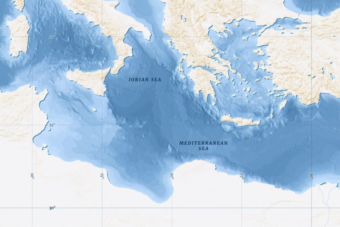
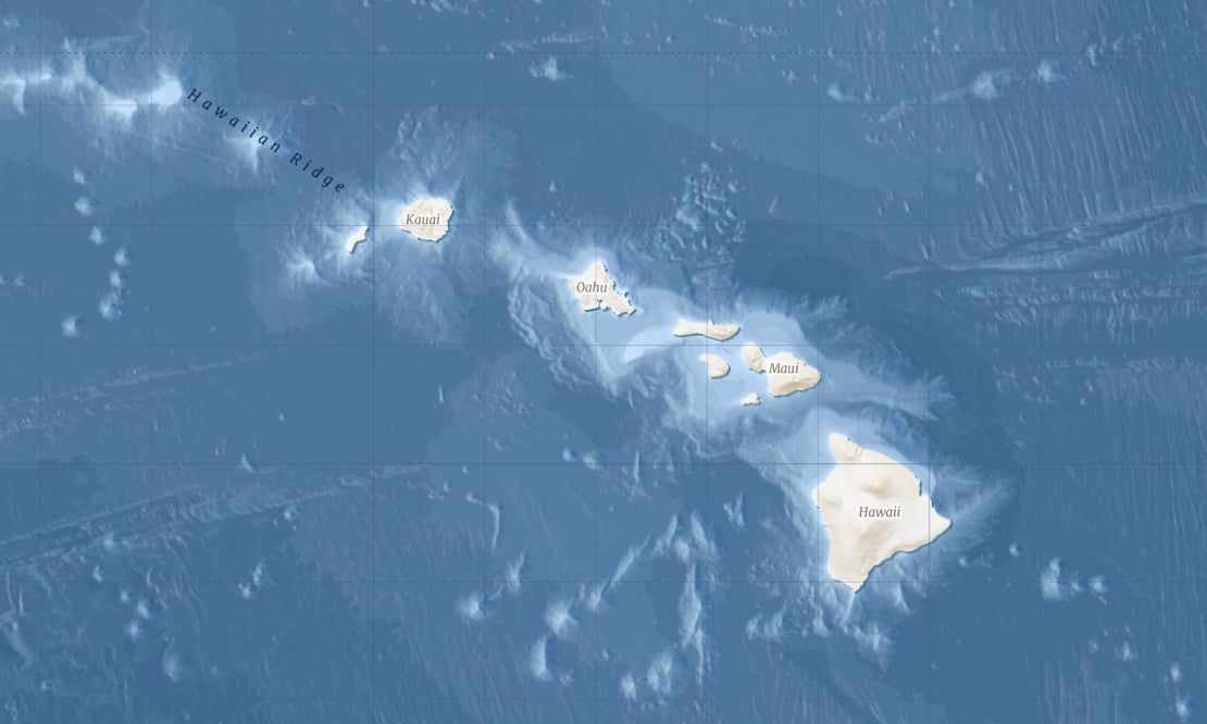
Visualize seafloor ridges, basins, and trenches in detail with high-resolution bathymetry, precise vector labels, and contour lines.
Maritime focus
Tailored for nautical use cases, cargo fleet tracking, infrastructure planning, and marine tourism.
Beautiful design
A stunning, fully customizable aesthetic that lets you create the perfect map for your use case.
Optimized for performance
Engineered for fast rendering to ensure a seamless experience on web and mobile.
Dark and Light maps for overlays


Reveal ocean terrain
Transform empty blue oceans into detailed landscapes with high-resolution bathymetry that reveals ridges, basins, and trenches.
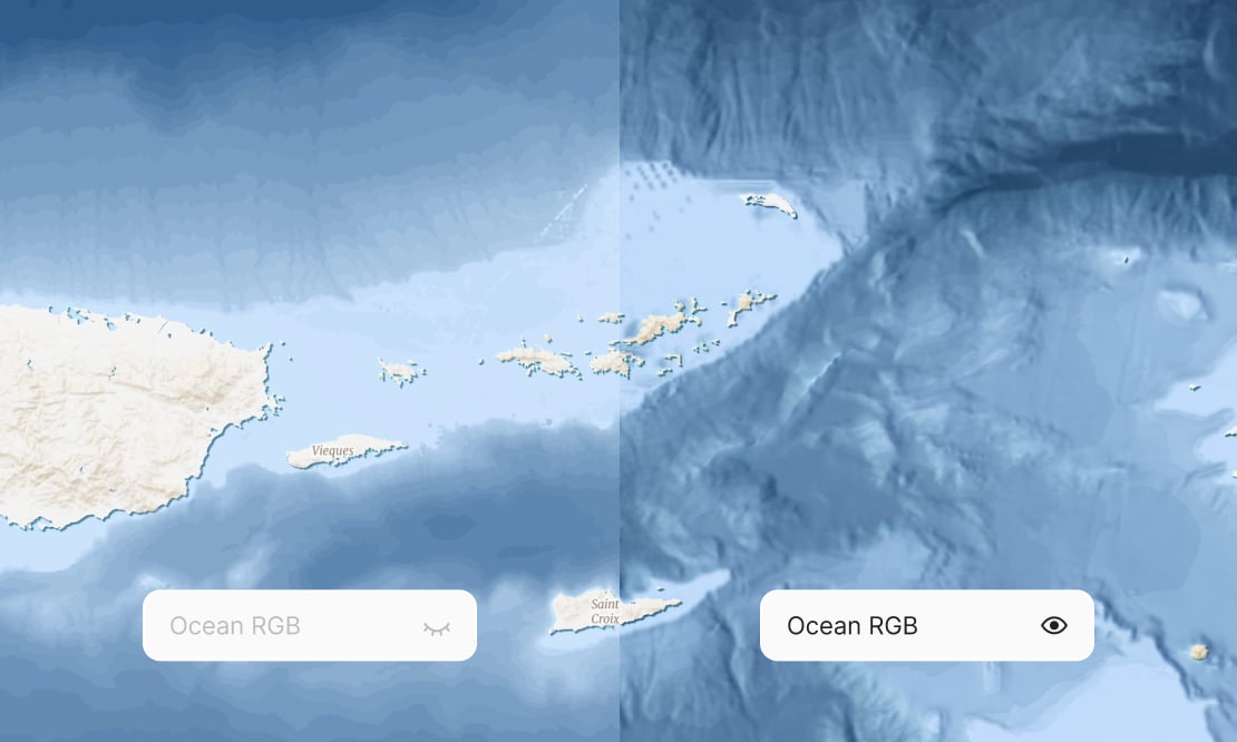
Dynamic elevation analysis
Use the Ocean RGB dataset to generate on-the-fly hillshades, colored slopes, and precise underwater elevation profiles.
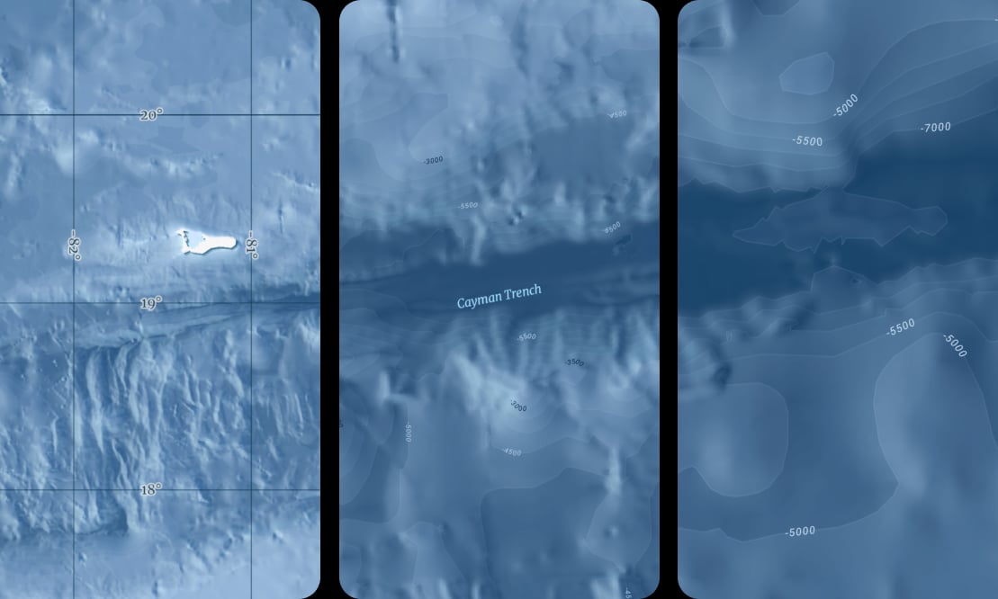
Plan your undersea infrastructure, such as fiber-optic cable routes, to avoid steep cliffs, active volcanic zones, and areas prone to underwater landslides.
Comprehensive navigation
Navigate with clarity using dedicated labels for undersea features, a grid with Eastings & Northings, and depth contours at every zoom level.
Start using Ocean via Maps API
https://api.maptiler.com/maps/ocean-v4/?key=YOUR-API-KEY