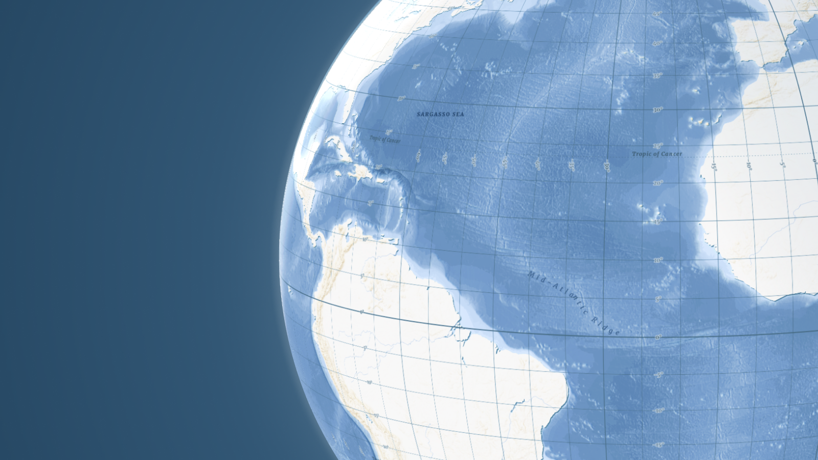
Uncover the depths typically hidden beneath a monochromatic blue covering 71% of the planet. Our Ocean map visualizes the seafloor's richness by revealing ridges, basins, and trenches in stunning detail. By combining high-resolution bathymetry with crisp vector labels and contours, we’ve created the ultimate base map for maritime, nautical, and environmental applications.
Elegant design and high performance
This map was engineered specifically for nautical use cases, cargo fleet tracking, undersea cables routing, siting marine infrastructure, and marine tourism. You can navigate with absolute clarity using dedicated labels for undersea features and depth contours that remain precise at every zoom level.

Using our map design tool, you can further customize every color and font to match your brand identity.
Seamless experience across both web and mobile platforms is ensured by full optimization for fast rendering.