Critical operations in backcountry environments require reliable, precise maps that enable rapid decision-making. Topo was engineered to provide the optimal balance of information at every zoom level, featuring high-resolution terrain data, on-the-fly unit conversion (metric and imperial), and multilingual support, all served via API or on-premises.
High-resolution terrain visualization
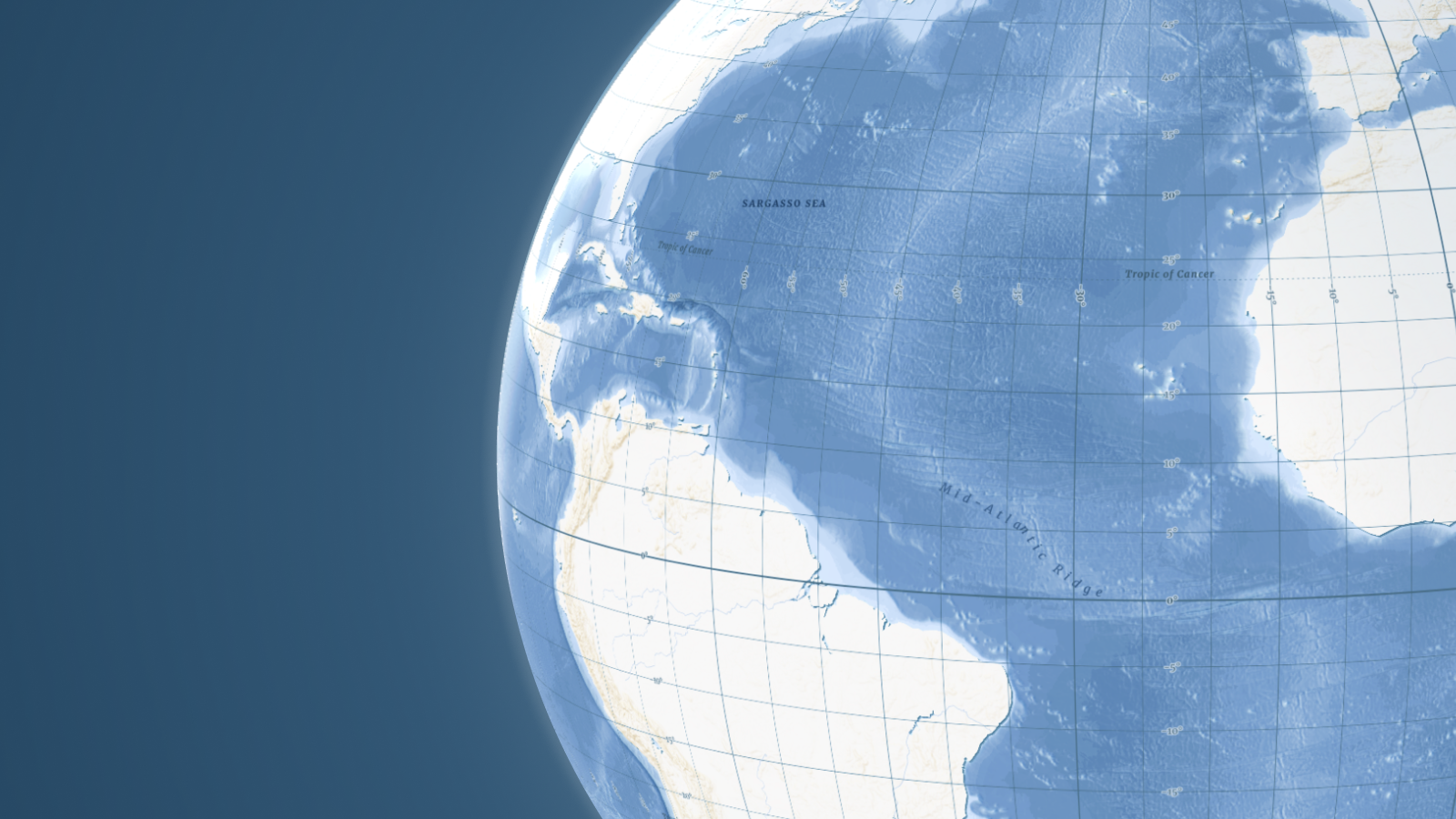
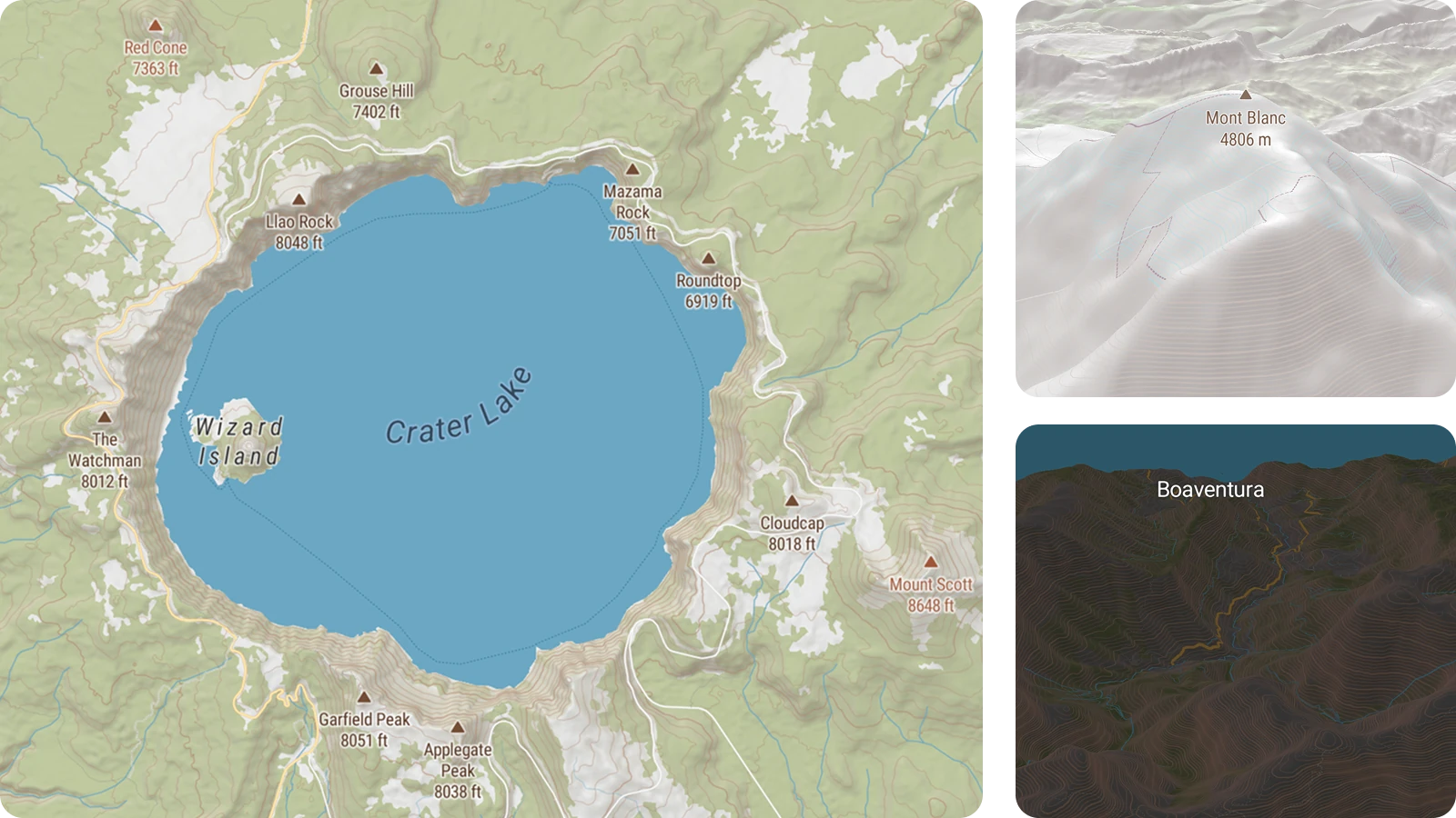
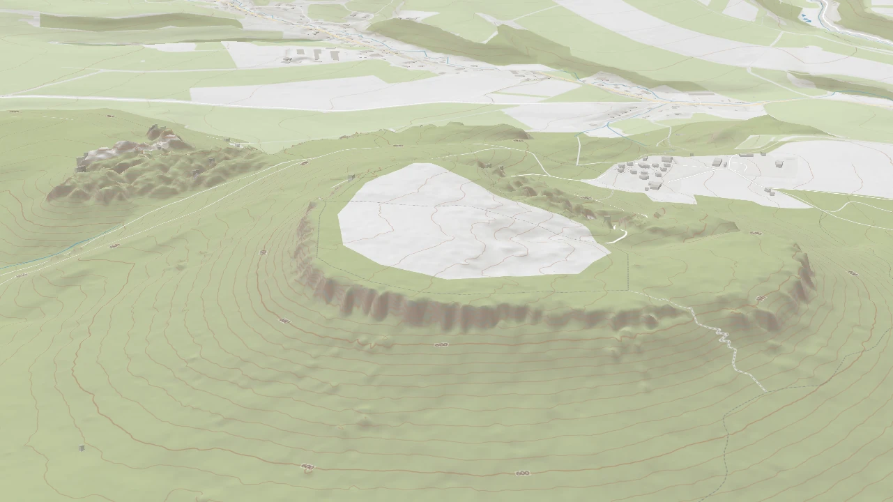
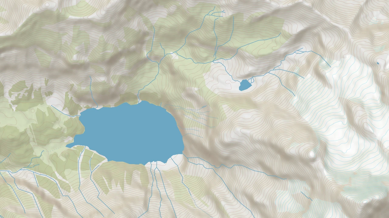
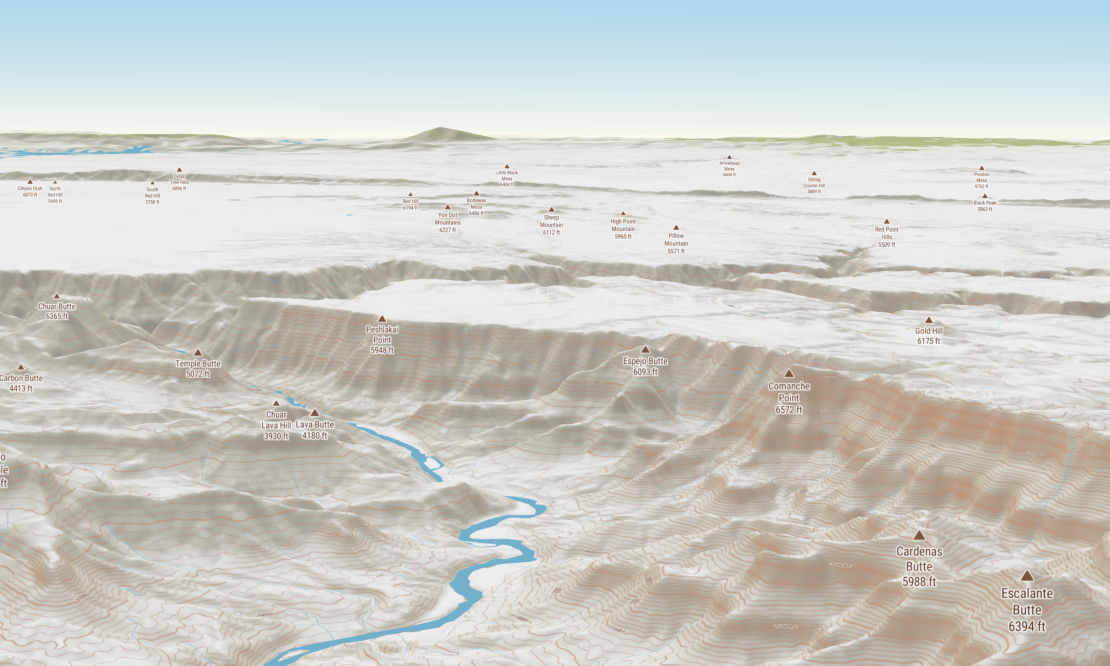
Users will benefit from a level of detail that surpasses standard maps by utilizing a global terrain dataset enhanced with high-resolution data in selected regions and dynamic contour lines. Topo doesn't just show you where a mountain is; it reveals its steepness and texture, making it the definitive basemap for outdoor navigation and logistics, where the shape of the land dictates mission success.
Global data with local clarity
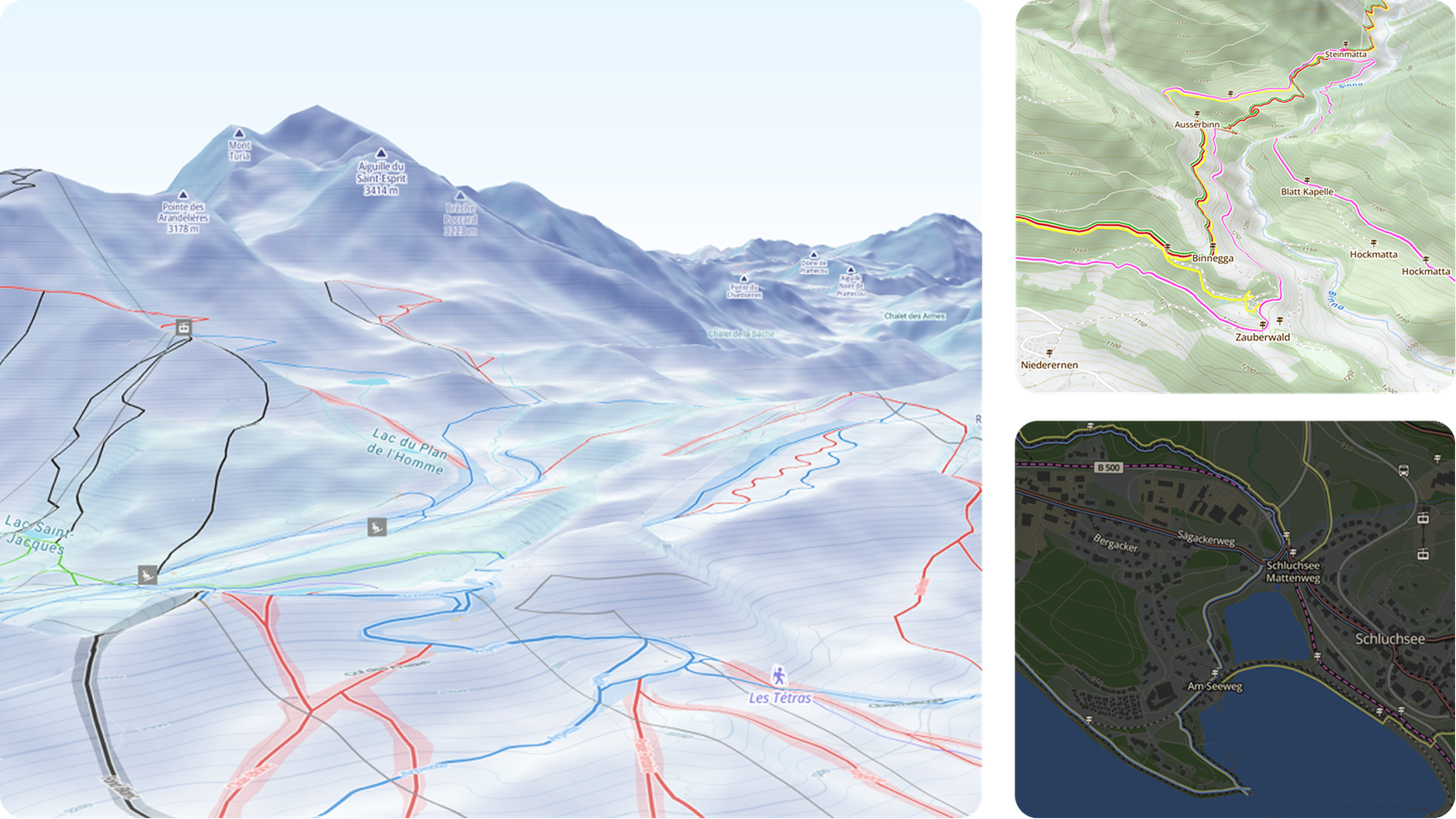
To ensure you never miss a critical landmark, the new dataset that powers the next generation of our maps provides granular detail at every zoom level: from strategic global overviews down to the "last mile" of a foot trail. It includes a comprehensive hierarchy of features, including specialized road classifications (like 4x4 tracks), hydrography, and vegetation markers (like marshes or forests).
Tactical and global versatility
Seamless cooperation of international teams and their coordination in various environments is taken care of by these key advantages:
- Integration of more than 70 local languages and native fonts
- Toggle between Metric and Imperial units to prevent conversion errors.
- Specialized Dark, Pastel, and high-contrast Topographique variants that mitigate eye strain and ensure data is legible whether in a sunlit vehicle or a pitch-black command tent.
Fast rendering maps for field devices
Our Topo style uses vector tiles to remain crisp and performant during rapid zooming or rotation. This technology ensures lightning-fast rendering even on lower-bandwidth field devices. Let's leave the pixelation and slow rendering times of raster maps in the past.
Available from the cloud or on-prem
The map is available via API from our online service or as an on-prem package (including the data and server) for air-gapped and mission-critical environments.