
Map your Smart City Data
Unify urban GIS layers and live IoT feeds into charts, maps, and 3D scenes. Backed by 99.9% uptime, complete data sovereignty, and enterprise-grade cloud security.
Interactive maps for smart city infrastructure
3D Digital twins & urban planning
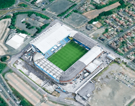
Visualize current city assets and future developments using 3D maps and photorealistic GeoSplats.
Smart city dashboards
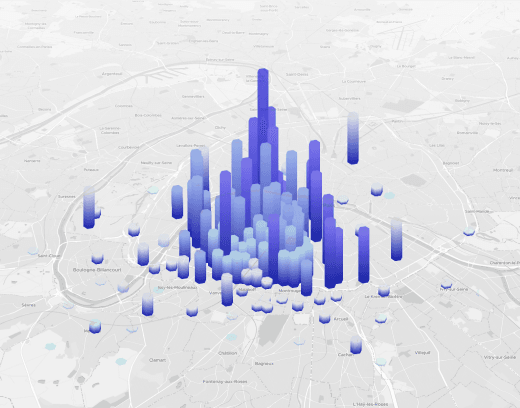
Display real-time air quality, mobility streams, traffic sensors, and utility feeds on top of fast vector basemaps.
Automated data processing
Process GIS datasets, CAD drawings, and drone imagery for deployment on cloud or private infrastructure.
Security & data sovereignty
Store data on secure infrastructure with guaranteed uptime, high reliability, and regional compliance.

Trusted by






Support planning with 3D visualization
Photorealistic GeoSplats of entire cities support urban planning, informed decision-making, public engagement, and local tourism. Stream GeoSplats directly in any web browser and enrich them with interactive points of interest, urban development updates, local services, and real-time IoT sensor data.

Hosting & security
Host your digital assets on a secure, scalable cloud platform. From GeoSplats and vector tilesets to satellite imagery and municipal GIS layers, MapTiler Cloud delivers 99.9% uptime, complete sovereignty, and predictable session-based pricing.

Basemaps & high-res satellite imagery
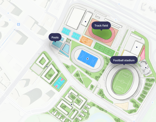
Use continuously updated satellite imagery and customizable 3D vector base maps as the ideal data visualization backdrop. Layer complex data over high-resolution aerial photography, detailed 2D & 3D street maps, or your own custom map style.

Data processing
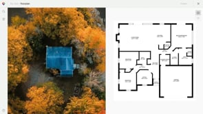
Process your geospatial data on MapTiler cloud or your own infrastructure. Pin city plans to their exact geographic coordinates using the Georeferencer, and bring your Esri ArcGIS or survey layers into fast, interactive web maps.
MapTiler is a mapping platform used by smart city developers and urban planners to process, host, and stream detailed basemaps, municipal GIS layers, 3D objects, and photorealistic 3D scenes called GeoSplats directly into web browsers. Unlike standard 2D map providers, MapTiler provides the hosting and rendering infrastructure needed to display complex 3D digital twins and live IoT feeds.
Gaussian Splatting renders photorealistic 3D environments using radiance fields rather than traditional textured polygon meshes. MapTiler's GeoSplats technology lets urban planners and platform developers view real-world city captures, including vegetation, structural details, and terrain. GeoSplats are fully georeferenced to real-world map coordinates and run natively in web browsers without requiring specialized app downloads. This makes them ideal for public portals as well as decision support tools.
Yes, MapTiler acts as an open delivery pipeline for municipal GIS layers created in Esri ArcGIS Urban, Pix4D, and XGrids hardware. You can transform 3D models, city maps, and survey scans into web-optimized MBTiles, bridging desktop GIS software directly to browser-based web maps.
MapTiler Cloud supports a wide range of 2D and 3D spatial formats for direct upload, hosting, and streaming:
-
3D & Reality Capture: GeoSplats (georeferenced Gaussian splat models)
-
Tiled Containers: MBTiles and GeoPackage containers (up to 100 GB) containing vector tiles (MVT) or raster map tiles (PNG, JPG, WebP).
-
Vector GIS Layers: Zipped Shapefiles (.shp), GeoJSON, KML, and GPX.
-
Raster Imagery & Aerials: High-resolution GeoTIFF, TIFF, ECW, MrSID, GeoJPEG2000, PNG, JPEG, and GeoPDF.
MapTiler Cloud gives you the tools you need to ensure data sovereignty and security for your Smart City projects.
-
We only ever process your data on your instruction; you always have 100% control.
-
You can select an optional EU-only API endpoint for projects that require EU data residency.
-
Your data is kept secure with encryption both in transit (TLS 1.2+) and at rest.
-
Custom enterprise contracts include a 99.9% uptime SLA.
MapTiler Georeferencer is a tool that assigns exact real-world geographic coordinates to unlocated images, historical maps, or master plans. City planners use Georeferencer to align 2D zoning overlays, historical maps, and scanned site plans directly onto satellite basemaps and 3D terrain.
Accelerate your smart city data pipeline
Stream complex 3D city models, GeoSplats, and CAD assets directly in the browser, backed by high-availability cloud infrastructure and complete data sovereignty. Evaluate for free, no credit card required.