Three new map styles with refreshed cartography with denser data across zoom levels are now available for public testing.
This release marks the first step toward a new generation of MapTiler maps — built to match your use cases, and ready for easy customization and fine-tuning to meet your needs.
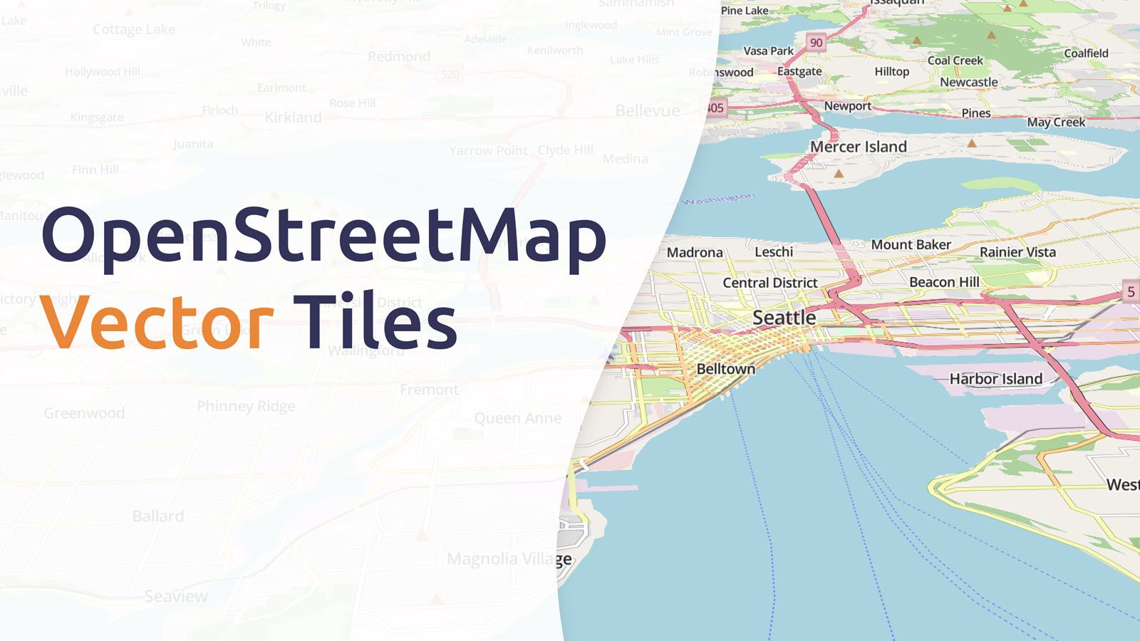
Streets v4: Map for transportation and logistics
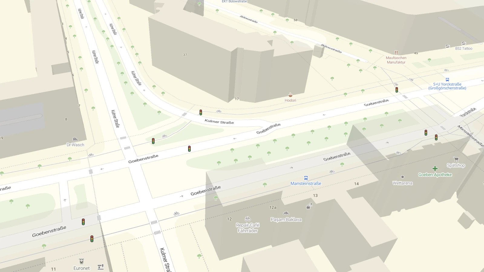
Streets has long been our flagship map product — a reference map used by professionals and developers around the world.
The new v4 Streets release introduces a fresh look and deeper detail, featuring:
- A brighter, more balanced color palette
- Refined typography and improved label density
- A wide range of new map icons
- More data layers and improved visual hierarchy
Designed primarily for transportation and navigation, Streets v4 fits seamlessly into:
- Logistics platforms and fleet dashboards
- Delivery and transit apps
- Bike-sharing systems, parking apps, and other high-traffic environments
The map now offers clearer differentiation of road types, localized highway shields that automatically adapt to each country’s style, and better road network verticality for improved readability. The new Streets map feels familiar, whether you’re driving in Germany, France, or Japan.
See what's exactly different in the map compare tool.
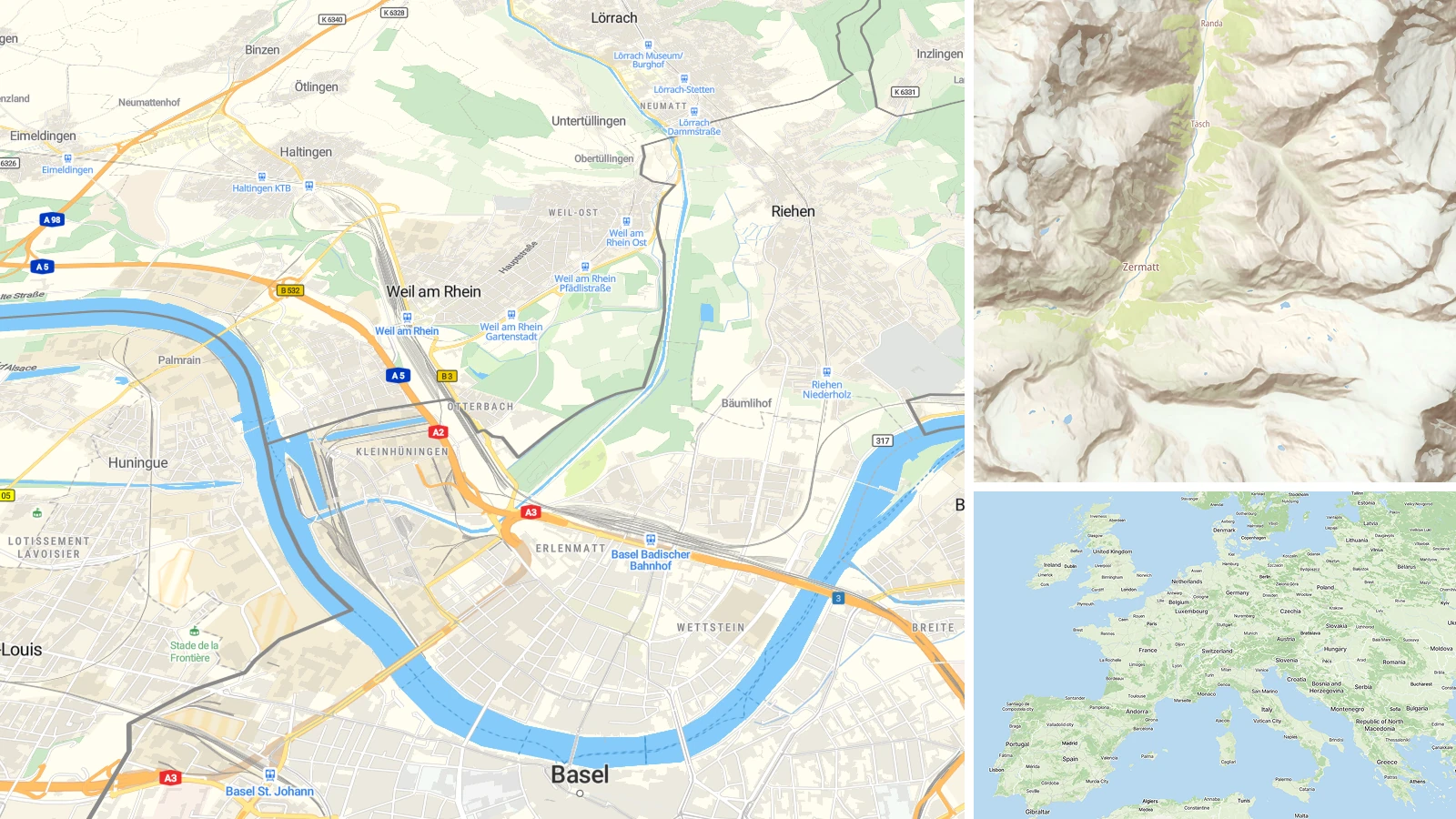
Landscape v4: An artistic base map

Landscape is a unique artistic base map crafted to bring both clarity and beauty to any data visualization. It provides a clean, elegant canvas that's ideal for:
- Hiking apps
- Tourism portals
- Custom dashboards
The standout feature of Landscape v4 is its hand-drawn hillshade raster layer, inspired by the classic technique of the renowned Swiss cartographer Eduard Ihmof. His pioneering approach to terrain shading — combining precision, artistry, and expressiveness — brings mountains, valleys, and plateaus to life with soft gradients and subtle relief. Landscape v4 pays homage to this legacy, blending traditional craftsmanship with modern cartography.
Base v4: The minimal, AI-ready backdrop

The new Base map is designed to be the simplest and most adaptable backdrop for your projects. Its minimal, clear, and unobtrusive style keeps the focus on your data while still providing essential geographic context.
The key features:
- AI-ready: This is the big step forward. Base v4 is built for automatic styling and intelligent adjustments.
- Quick edits: Easily adjust colors and styles in just a few clicks for fast, intuitive customization.
- Light & Dark variants: Like all MapTiler styles, it comes in both themes to fit your design.
Whether you're building a hiking app, creating a tourism portal, or designing a custom dashboard, this new style offers a clean canvas that elevates your data.
Powered by MapTiler Planet v4
All new styles are powered by the latest version of MapTiler Planet. The new underlying tileset brings high-quality vector tiles down to a highly detailed, street-level view. More data is available earlier in the zoom pyramid, ensuring a smooth experience from global to local map views.
Designed for a worldwide audience, with translations and country-codes now included in most features, MapTiler Planet delivers reliable, accurate, and up-to-date mapping at every zoom level.
Try them today
You can explore the new styles right now — create a new MapTiler account and explore it using the map design tool.
What’s next?
This is the first wave of new styles, more are coming in the next few weeks. Over time, these new versions will replace the original styles and become the default for new maps.
Don't worry, existing maps will continue to work with older styles. You’ll be notified well in advance before any deprecation.