MapTiler Countries: country boundaries and postal and administrative units
Build maps with ready-to-use detailed boundaries of administrative divisions and postal areas. Merge your data and build beautiful maps providing insights.
Explore administrative units
countries & states, divisions, provinces, municipalities, regions, districts, zip codes
Are you missing a feature, or have a request?
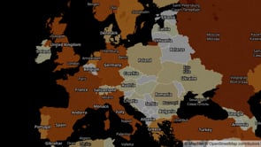
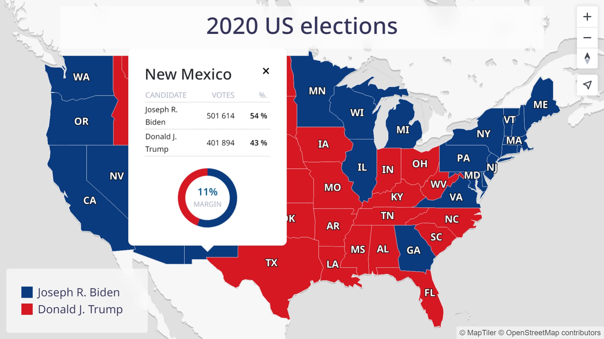
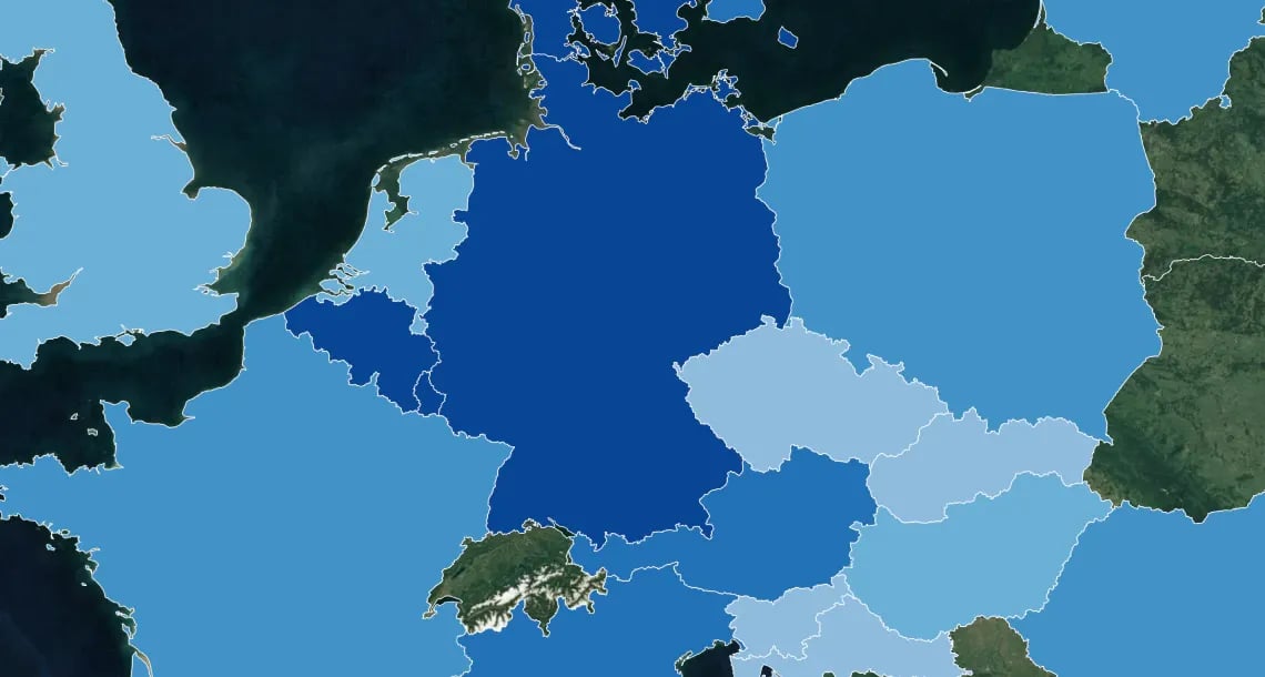
Election maps using state and county boundaries
All the boundaries you need to build election maps in Europe, the USA, and many other countries around the world.
Build interactive JavaScript maps or create animated maps for broadcast, run on premise or hosted on the cloud.
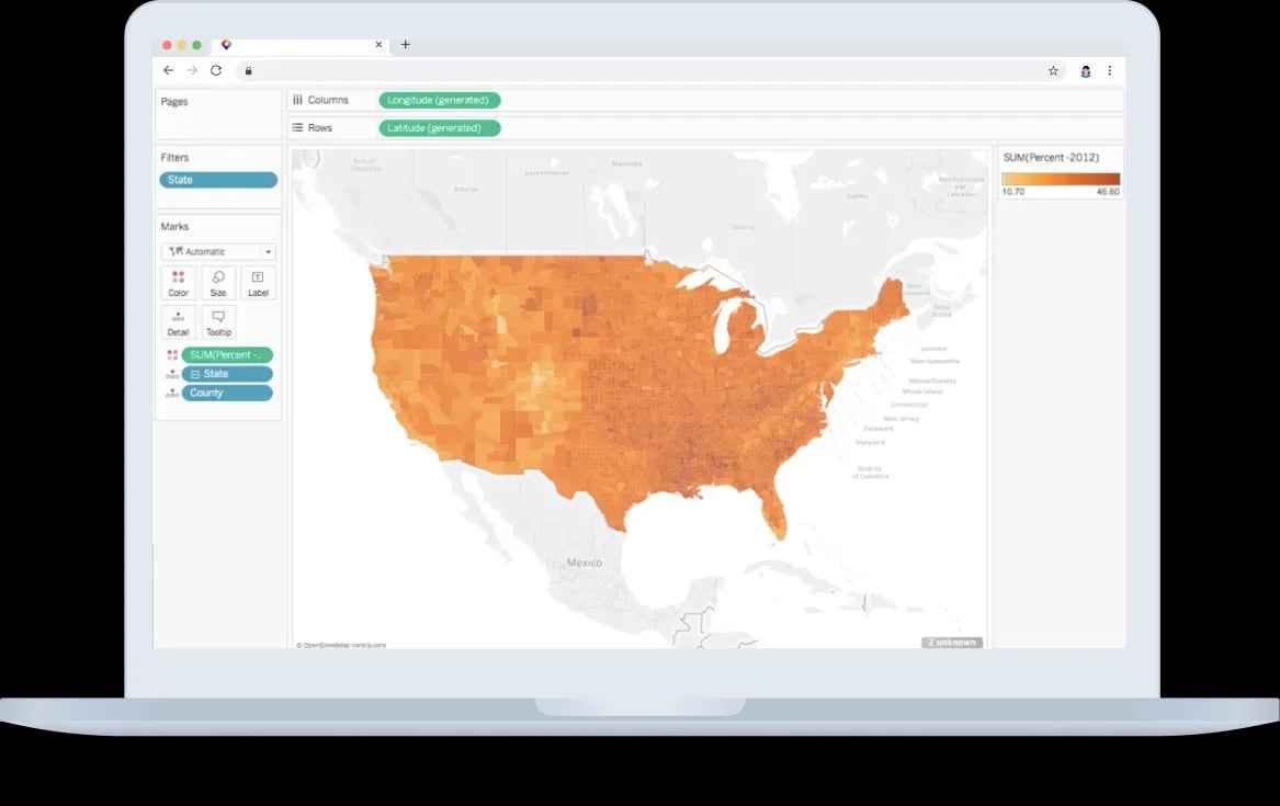
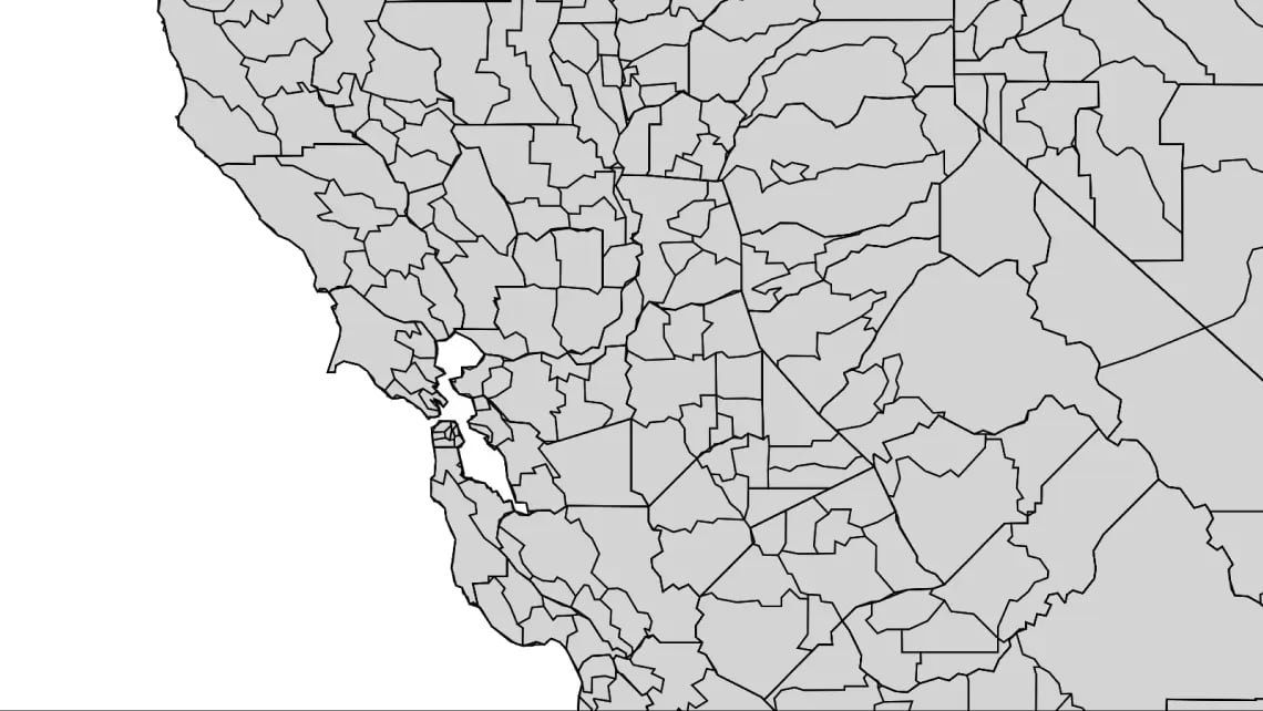
District polygons for choropleth maps
Use detailed boundary data of the entire world and administrative units & postal areas of the most frequently displayed regions, to present data to your audience on overview maps.
Color countries and their divisions to show election results, sociological & demographical data and more.
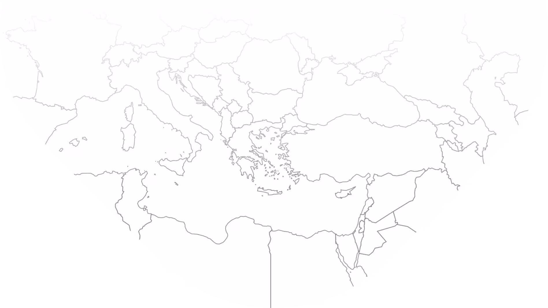
Precise geometries at every zoom level
Make your data stand out by using our accurate boundaries. The borders of sub-divisions match precisely with the countries and let users focus on exploring the information without distraction.
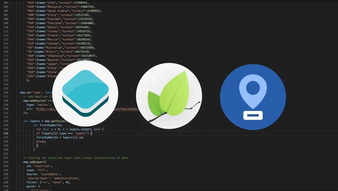
Join data from your analysis to locations using names, ISO Alpha-2, codes, Wikidata ID, and other attributes included in the vector tiles.
Join your spreadsheet to boundaries & regions
Display & style data using MapTiler SDK and other standard web JavaScript libraries. Join your tabular data with MapTiler Countries to style datasets directly in the code.
Do you have dynamically changing data? Create real-time visualizations based on shared files. Load MapTiler Countries using the API and connect it using the attributes included.

Show atractive infographics in
News & Media
START HERE

Boost your publication with a
choropleth map
LEARN HOW TO PRINT MAPS

Make stunning video maps
using Adobe After Effects
START HERE
Do you need exemption from visible copyright?
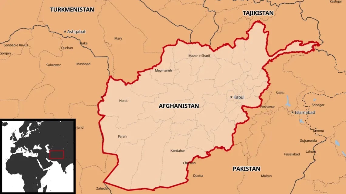
Highlight countries and territorial units on a map
Are you sharing information about a region or state? Do you want to show where the latest news is happening? Highlight it easily on a map using MapTiler Countries. Define the country or region you want to share, and change the color of the polygons and lines.
Combine MapTiler countries with MapTiler Planet or MapTiler Planet Lite to get the city names. That is a perfect way to give geographical context to your post or news without additional cost. The dataset is available in every account on MapTiler Cloud.
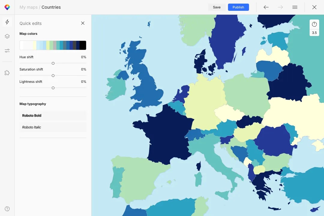
Visually style admin units in your browser
Choose the administrative or postal layers you want and customize them using the Edit Style tool. Set the colors of chosen states or territories, filter out those you don’t want to show, all directly in your browser.
By switching layers on and off and on, adding new ones, filtering areas by attribute, you can build a brand new choropleth map hosted via MapTiler Cloud.
Make your data stand out
Show your data with context. Whether you show data for the entire world or just one region, MapTiler Cloud offers ready-to-use street and satellite basemaps. Choose the perfect map for your data.
Do you need map that fits your brand or web design? Make your own map style in just a few click with the Customize tool. Change colors of layers, and choose fitting font for labels.