If you have ever worked with maps either on paper, or digitally on the web or in GIS software, then you will have almost certainly encountered X and Y coordinates as a way of giving a location. The concept is simple, like high school geometry, but handling X and Y coordinates can get complicated fast. This guide covers the use of X and Y coordinates for flat “cartesian” maps (we’ll explain this, don’t worry!) and not the Latitude and Longitude used for spherical “globe” systems.
Easting and Northing: What are X and Y coordinates on a map?
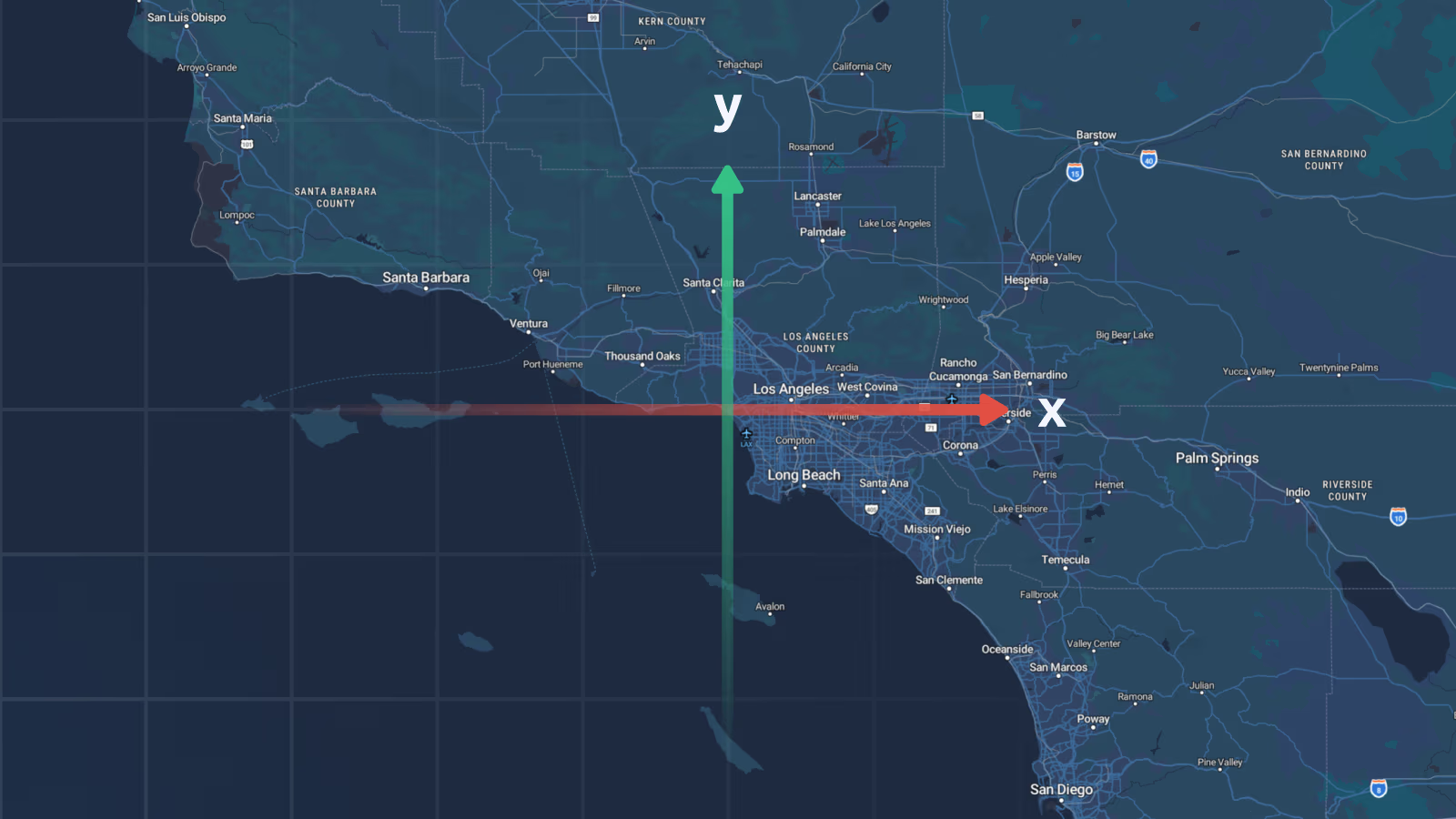
In Geographic Information Systems (GIS) and cartography, X and Y coordinates define a specific location on a two-dimensional, flat grid using a Cartesian coordinate system. We convert the 3D globe into a 2D Cartesian grid, using a mathematical algorithm called a map projection. This translates spherical latitude and longitude into flat X, Y coordinates.
Standard web-mapping projections, like Web Mercator, flatten the curved surface of the Earth so your code can plot geographic data directly onto a 2D screen coordinate system. Unlike spherical GPS (Lat, Lon) coordinates, projected coordinates use linear units like meters or feet measured from a designated origin point (0, 0).
- X Coordinate (Easting): Represents the horizontal position along the east-west axis. It measures how far east a point is relative to the origin.
- Y Coordinate (Northing): Represents the vertical position along the north-south axis. It measures how far north a point is relative to the origin.
For instance, in the Universal Transverse Mercator (UTM) grid system, Easting (X) and Northing (Y) values are strictly expressed in linear meters. This allows engineers, architects, and GIS specialists to calculate exact straight-line distances, surface areas, and structural bounds using simple Pythagorean geometry (a² + b² = c²) rather than solving complex spherical trigonometry across a curved Earth model.
Common X & Y coordinate pitfalls & how to avoid them
When working with spatial coordinate data, you will probably encounter one of these common errors:
- Axis order confusion (X/Y vs. Y/X): Math graphs use [X, Y], but geography often uses (Latitude, Longitude). Passing [Y, X] data into systems expecting [X, Y] (like GeoJSON or MapTiler SDK) will flip your coordinates across the equator or central meridian.
- Missing datum transformations: Projections that turn rely on underlying Earth models (datums) like WGS84 or NAD83. Converting coordinates between different datums without applying a datum shift grid causes positional errors ranging from 2 to over 200 meters.
- Mixing measurement units: Regional grids use International Feet, US Survey Feet, or Meters. Plotting foot-based coordinates directly onto a Web Mercator meter grid without unit scaling creates noticeable alignment offsets.
Real-world applications: Where are X & Y coordinates used?
While raw latitude and longitude dominate consumer navigation apps, flat X and Y coordinates serve as the operational backbone across professional industries that require high spatial accuracy and flat, linear measurement.
Cadaster mapping and land registry
Municipalities and land registries store property boundaries, land ownership parcels, and tax maps using local or national projected grid systems. Since property lines require exact ground measurements in meters or feet, land records use local X and Y coordinates to keep legal boundaries accurate.
Civil engineering, CAD, and architecture
When building highways, bridges, tunnels, or commercial real estate, engineers work in Computer-Aided Design (CAD) software like AutoCAD or MicroStation. CAD environments operate natively on 2D and 3D Cartesian X and Y coordinate grids. Integrating CAD site plans into a web map requires transforming those local X/Y engineering coordinates into a global projected reference system.
Drone mapping and aerial photogrammetry
Unmanned Aerial Vehicles (UAVs) capture high-resolution imagery to generate orthomosaics, 3D mesh models, and digital elevation models (DEMs). To stitch photos accurately and calculate volumetric stockpiles, drone mapping platforms project raw flight GPS logs into flat regional X/Y grid coordinates.
Interactive web maps and vector tiles
Web mapping engines render map features on a flat computer or mobile screen. Interactive map SDKs convert underlying spatial datasets into 2D screen pixels using projected X and Y meter grids, enabling smooth pan and zoom across zoom levels.
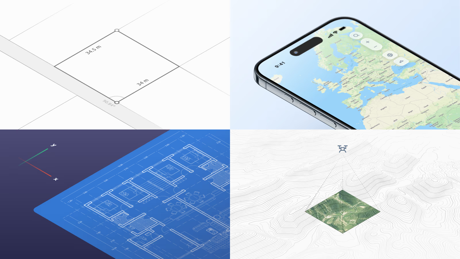
How different industries use X & Y coordinates
X & Y coordinates vs. latitude & longitude
The most common point of confusion is mixing up geographic coordinates with projected (planar) coordinates. Latitude and Longitude measure spherical angles (degrees) on a curved 3D globe, whereas X and Y coordinates measure flat linear distances (meters or feet) on a 2D map projection. The table below breaks down the key technical differences between these two systems:
| Characteristic | Latitude & Longitude | X & Y coordinates |
|---|---|---|
| System type | Geographic/Spherical | Projected/Planar (Cartesian) |
| Measurement units | Angular (Degrees, Minutes, Seconds or Decimal Degrees) | Linear (Meters, Feet, Kilometers) |
| Primary reference | 3D Ellipsoid (e.g., WGS 84) | 2D Flat Surface / Map Projection |
| Typical EPSG* | EPSG:4326 | EPSG:3857 |
| Use cases | GPS navigation, raw location tracking | Web map rendering, cadastre mapping, construction, CAD |
*Note on EPSG Codes: EPSG stands for the European Petroleum Survey Group, which created a standard catalog of spatial ID numbers. In mapping software, an EPSG code (like EPSG:4326 for GPS degrees or EPSG:3857 for Web Mercator meters) tells your application exactly which coordinate system, grid, and measurement units your data uses.
Transform X & Y coordinates with MapTiler
Whether you need to search definitions across 10,000+ global Coordinate Reference Systems, convert CAD survey grids to Web Mercator meters, or run high-throughput batch transformations on municipal datasets, our tools handle the heavy lifting. Leave complex geodetic calculations to us and focus on building great maps for your users.
Transform Coordinates for Free Explore the Coordinates API Docs