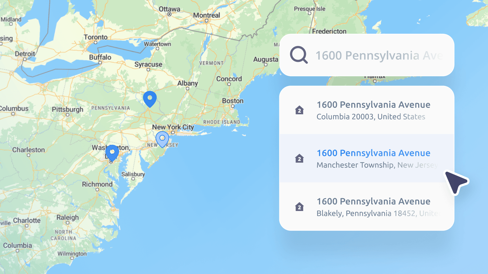
When you type a series of letters and numbers into an online checkout form or a Sat Nav, you rarely think about the complex global network guiding your request. Yet, postal codes and ZIP codes are the silent gears of global commerce, logistics, and data analysis.
Behind the scenes, a split-second chain reaction takes place. Standard global formats ensure your address is recognized worldwide, a digital database called a geocoder (play with MapTiler's here) translates those numbers into precise coordinates, and a global content delivery network (CDN) streams the correct map tiles to process your request in milliseconds.
But what is the actual difference between a ZIP code and a postcode? How do these systems work globally, and why do modern businesses look at them as geographical zones rather than just static strings of numbers? Let us break down the basics of postal geography.
What is a postal code
A postal code, also called a postcode or PIN, is a short sequence of numbers or letters in an address. Its primary job is simple: it helps postal services sort and route mail.
The origin: The concept was introduced to automate the manual sorting of physical mail. While early systems emerged in Ukraine and Germany in the 1930s, modern, nationwide postal code systems took off globally in the late 1950s and 1960s.
Structure variations: Some countries use strictly numeric structures (for example, France and Germany), while others use alphanumeric strings (for example, the United Kingdom, Canada, and the Netherlands) which allow for much tighter, highly localized targeting.
What is a ZIP code
A ZIP code is simply the United States’ specific brand of postal code. Introduced by the United States Postal Service (USPS) in 1963, "ZIP" is actually an acronym for Zone Improvement Plan. The system was designed to handle the post-WWII boom in mail volume by introducing a structured 5-digit number:
- Digit 1: Represents a broad group of U.S. states (for example, 0 for the Northeast, 9 for the West Coast).
- Digits 2 and 3: Represent a central post office distribution region.
- Digits 4 and 5: Represent the specific local post office or delivery area.
In 1983, the system expanded to ZIP+4, adding a hyphen and four extra digits to pinpoint highly specific locations. These extra digits can narrow a location down to a single side of a city block, a specific floor, or even a massive skyscraper.
The famous examples
The Empire State Building: Because of its immense daily mail volume, this legendary skyscraper is treated like its own mini-city with a unique five-digit ZIP code: 10118. When mailing the building, using the full ZIP+4 code 10118-9998 routes delivery directly to the building's main mail distribution hub.
The White House: The President's residence uses specific ZIP+4 suffixes to filter incoming mail instantly. Sending mail to 20500-0001 routes it straight to the President, while changing the last digit to -0002 routes it to the First Lady.
Different names for address codes around the world
Depending on where your business operates, the term "postal code" changes dramatically. For instance, Germany uses PLZ (Postleitzahl), Brazil uses CEP (Código de Endereçamento Postal), and India uses a PIN Code (Postal Index Number).
While these systems are largely numeric, some countries have abandoned traditional postal codes altogether. A prime example is the United Arab Emirates (UAE), which uses P.O. Boxes for mail delivery instead of assigning ZIP codes to geographic zones. When filling out online forms, residents in cities like Dubai typically use placeholders like 00000. To solve this, Dubai introduced Makani numbers, a unique 10-digit code physically assigned to every building entrance to serve as a high-precision digital coordinate.
While the UAE’s point-based coordinates represent one end of the spectrum, other countries around the world use incredibly diverse and rigid structures. To help you navigate these global differences, we have compiled a quick-reference table to the most highly searched (and developer-confused) postal systems on the planet:
Country | Code name | Format type | Example format | Character length | What you need to know |
Brazil | CEP | Numeric (with hyphen) | 01000-000 | 9 characters (including hyphen) | The 8-digit code split by a hyphen is notorious for causing database submission errors in Latin America. |
Canada | Postal Code | Alpha-numeric (alternating) | M5H 2M9 | 7 characters (including space) | The alternating letter-number-letter sequence (A1A 1A1) easily confuses numeric-only database fields. |
India | PIN Code | Numeric | 110001 | 6 digits | The term "PIN" is highly searched because people confuse it with personal bank security PINs. |
Ireland | Eircode | Alpha-numeric | D02 X285 | 8 characters (including space) | Ireland's system is highly searched because it points to an individual building rather than a broad regional area. |
Japan | Yūbin Bangō | Numeric (with hyphen) | 〒150-0001 | 8 characters (including hyphen) | It uses a hyphen and is frequently preceded by the unique Japanese postal symbol (〒). |
United Arab Emirates | Makani (Dubai) / P.O. Box | Smart Point Code / Box Number | 12345 67890 (Makani) or P.O. Box 1234 | 10 digits (Makani) or custom | The UAE has no standard postal code. International checkouts frequently require custom workarounds. |
United Kingdom | Postcode | Alpha-numeric (with middle space) | SW1A 2AA | 6 to 8 characters | The space in the middle and varying lengths require complex coding patterns (RegEx) to validate. |
United States | ZIP Code | Numeric (plus optional suffix) | 10118 or 10118-0110 | 5 or 10 characters | The "ZIP+4" hyphenated expansion frequently breaks standard form validations. |
Points versus boundaries: The geographic mapping challenge
The UAE's building-specific Makani numbers compared to Germany's broad PLZ zones highlight a fundamental geographical concept: the difference between a point and a boundary.
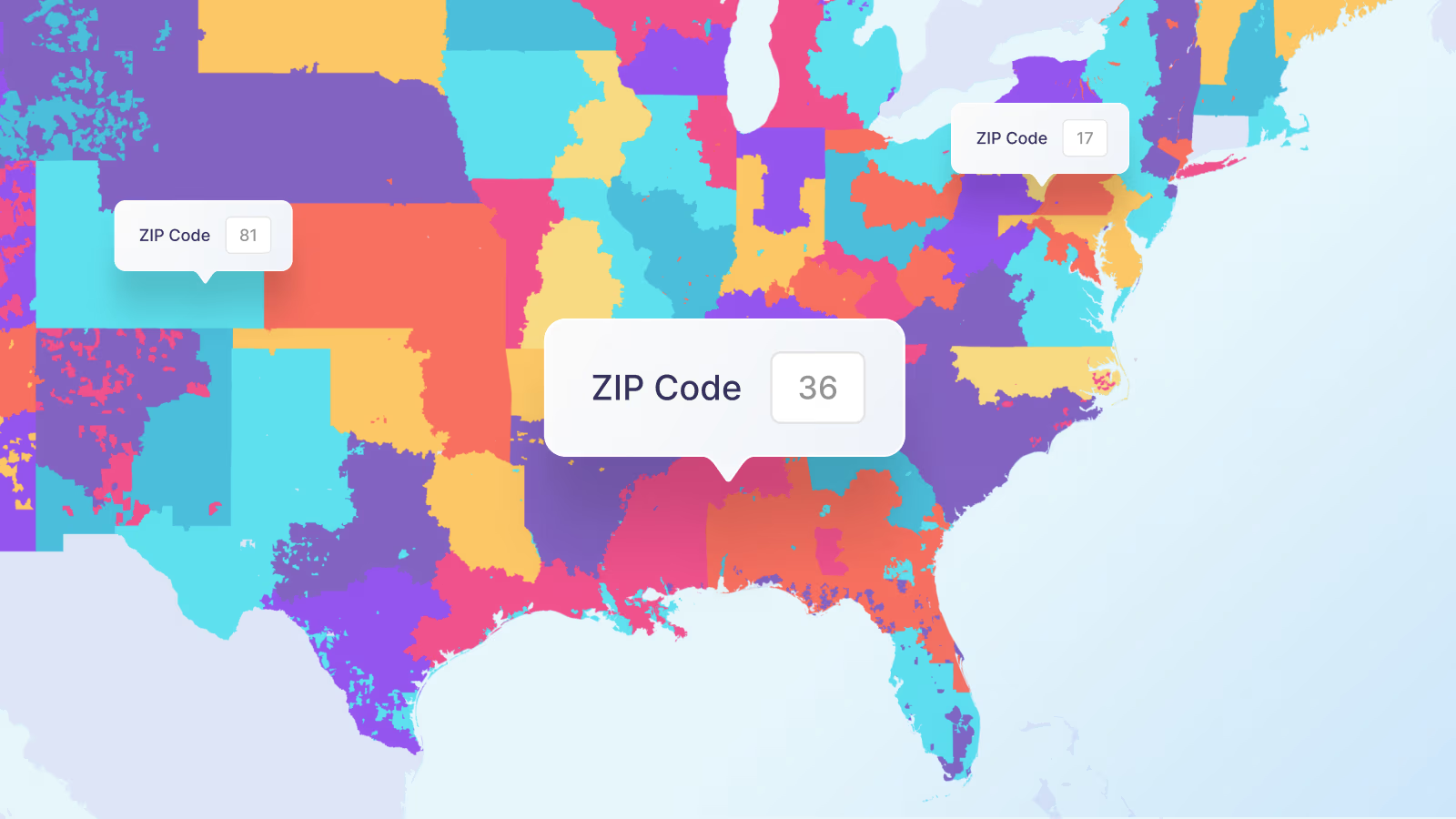
To a GPS or an address form, a postal code is often treated as a single coordinate point on a map. However, to businesses running logistics, delivery networks, or sales regions, a postal code represents a physical boundary (a territorial zone). Visualizing these boundaries is a major challenge for three reasons:
- They are not natural shapes: Postal zones are drawn for mail delivery routes, not for geometric symmetry. They wrap around rivers, highways, and administrative borders in unpredictable ways.
- They change constantly: Municipalities split, expand, or retire postal routes regularly to keep up with suburban development and population growth.
- They are invisible lines: Because you cannot see where one postal zone ends and another begins, businesses require accurate, updated geographic map databases to turn raw coordinates into visible, colored zones on a map.
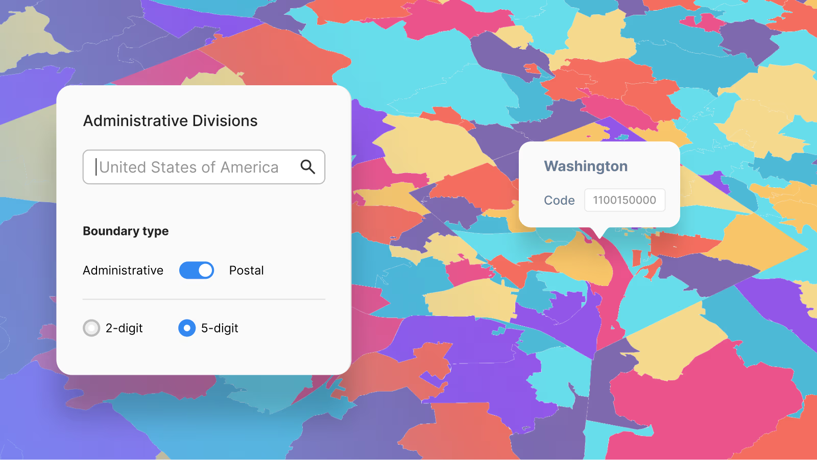
Explore administrative units on our live demo map
Not all codes are areas: The 4 main types of postal codes
This distinction between exact points and regional boundaries becomes even clearer when you look at how postal services categorize codes. In the mapping world, postal codes are divided into four distinct types depending on their physical function:
- Standard codes: These are the traditional geographic areas. They define a physical territory, neighborhood, or delivery route that a mail carrier walks or drives through.
- PO Box-only codes: These do not represent a geographic area of houses. They point exclusively to physical Post Office Box lobbies inside a specific postal facility.
- Unique or single-entity codes: These are assigned to a single high-volume location. For example, massive universities, government headquarters, or skyscrapers (like the Empire State Building) get their own unique code to bypass standard regional sorting lines. On a map, these are treated as individual points rather than zones.
- Military codes: Used to route mail to armed forces stationed overseas. These are virtual routing codes that do not map to any permanent physical topography.
The developer’s bottleneck: Garbage in, garbage out
While these use cases are lucrative for businesses, they all share a single, fragile dependency: clean data. If a customer makes a typo in their address during a checkout flow, or a mobile app submits an incorrectly formatted location string, the entire logistics or data analysis engine breaks down. To turn raw location data into reliable business intelligence, software engineers must build systems that catch these mistakes at the point of entry.
How to parse and validate global postal codes
For developers building address autocomplete fields, checkout forms, or logistics dashboards, dealing with messy user input is a constant headache. To build a functional platform, teams generally rely on two core validation methods: Regular Expressions (Regex) for basic formatting, and Geocoding APIs for real-world verification.
What is Regex (Regular Expressions)?
Think of Regex as a highly advanced search and replace pattern. It is a sequence of special characters that forms a search pattern, allowing developers to check if a user's input matches a specific format rule. Developers typically use Regex in two ways:
- Input validation: Ensuring a user typed a correctly formatted code into a checkout form before allowing them to hit "Submit" (using strict boundary anchors like ^...$).
- Data extraction: Scanning an entire block of text to pull out any postal codes hidden inside it (using global flags like /g).
While Regex is incredibly fast, it has one major limitation: it only checks the syntax, not reality. A regex pattern can tell you if a string looks like a valid US ZIP code (for example, 99999), but it cannot tell you if that ZIP code actually exists or if it belongs to an empty field in the middle of a desert.
Beyond syntax: Verifying data with the MapTiler Geocoding API
To truly validate an address, businesses must go beyond format checks and verify the data against real-world geographic coordinates. This is where a professional data service like the MapTiler Geocoding API becomes indispensable.
Instead of maintaining thousands of complex Regex lines for every country on earth, developers can pass a raw address string directly to a geocoding engine.
The power of an address search API
When a user types an address into your application, MapTiler's Geocoding API processes the text, standardizes the formatting errors, and returns a fully structured JSON response.
For example, if an application requests data for a localized address string, the API instantly parses the components:
JSON
{
  "type": "Feature",
  "geometry": {
    "type": "Point",
    "coordinates": [ -2.961697, 53.455278 ]
  },
  "properties": {
    "street": "Rice Lane",
    "city": "Liverpool",
    "postcode": "L9 1NL",
    "country": "United Kingdom",
    "country_code": "gb",
    "formatted": "Rice Lane, Liverpool, L9 1NL, United Kingdom"
  }
}
Why API validation beats manual coding
Real-world verification: It guarantees the postal code actually exists and can be mapped to physical coordinates.
Error correction: If a user makes a typo in their street name but inputs the correct postal code, a smart geocoder can fix the mistake automatically.
Automatic maintenance: As global postal boundaries change, split, or expand, the cloud-hosted API updates automatically behind the scenes. Developers never have to rewrite their code to accommodate new municipal updates.
Transforming raw address strings into visual map zones
Once a geocoding API turns a messy address list into precise coordinates, the final step for any application is rendering that data onto a visual map layer. This is where specialized geographic boundary datasets come into play. Instead of forcing developers to build coordinate shapes from scratch, solutions like MapTiler Countries provide ready-to-use, cloud-hosted digital boundaries for countries, states, and postal zones.
By plugging these dynamic datasets directly into an interactive map engine, businesses can easily build custom dashboards that automatically color-code different neighborhoods based on their internal data. Whether you are mapping localized sales volume or establishing physical delivery zones, the map updates instantly as users pan and zoom, turning raw text strings into powerful visual business intelligence.
How businesses use ZIP Codes and postcodes
From mail sorting to business intelligence, postal boundaries are used for far more than sending letters. These codes often represent a certain number of addresses; they can be a good proxy for the number of people living in that area. This means that companies across dozens of sectors rely on them to power daily operations:
- Delivery and logistics: Defining delivery zones, optimizing delivery driver routes, and calculating shipping rates based on zone distance.
- Retail and real estate: Analyzing local demographics, determining where to build new retail locations, or mapping home values by area.
- Insurance and risk assessment: Mapping flood plains or fire risks relative to property postal zones to set accurate policy premiums.
- Telecom and utilities (service coverage): Broadband providers, mobile network operators, and energy companies map postal boundaries to plan infrastructure rollouts. If a telecom company wants to deploy 5G or fiber-optic cables, they use postal zones to analyze which neighborhoods have the highest demand and where their coverage gaps currently exist.
- Healthcare and epidemiology (public health): Hospitals, health agencies, and pharmaceutical companies use postal zones to track the spread of diseases, analyze regional health trends, and decide where to build new urgent care clinics based on local population density.
- Marketing and advertising (hyper-local targeting): Modern digital advertisers use postal boundaries for geo-targeted campaigns. Instead of wasting ad budget showing a promotion to an entire city, a business can configure social media or search engine ads to show only to users physically located within highly specific, high-income postal zones.
- Public sector and urban planning (resource allocation): Municipalities, city planners, and emergency services rely heavily on postal boundaries. They use them to optimize trash collection routes, draw public school enrollment zones, and allocate police or fire department resources to the areas that need them most.
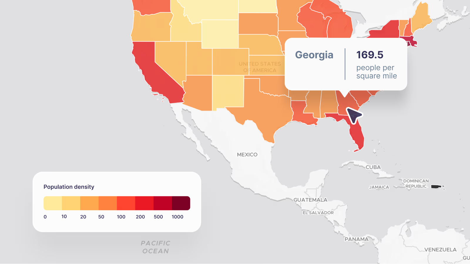
Create your own choropleth map
Ready to build your own map platform?
Don't let complex global postal formats break your checkout forms or logistics routes. Discover how easy it is to parse addresses, verify locations, and render reliable borders using our Geocoding API and Countries dataset.