
Create and edit vector data
Easily digitize satellite imagery by creating geometry and adding annotations. Collaborate with your team or work solo on your mapping projects. Included in all Cloud plans.
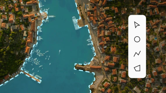
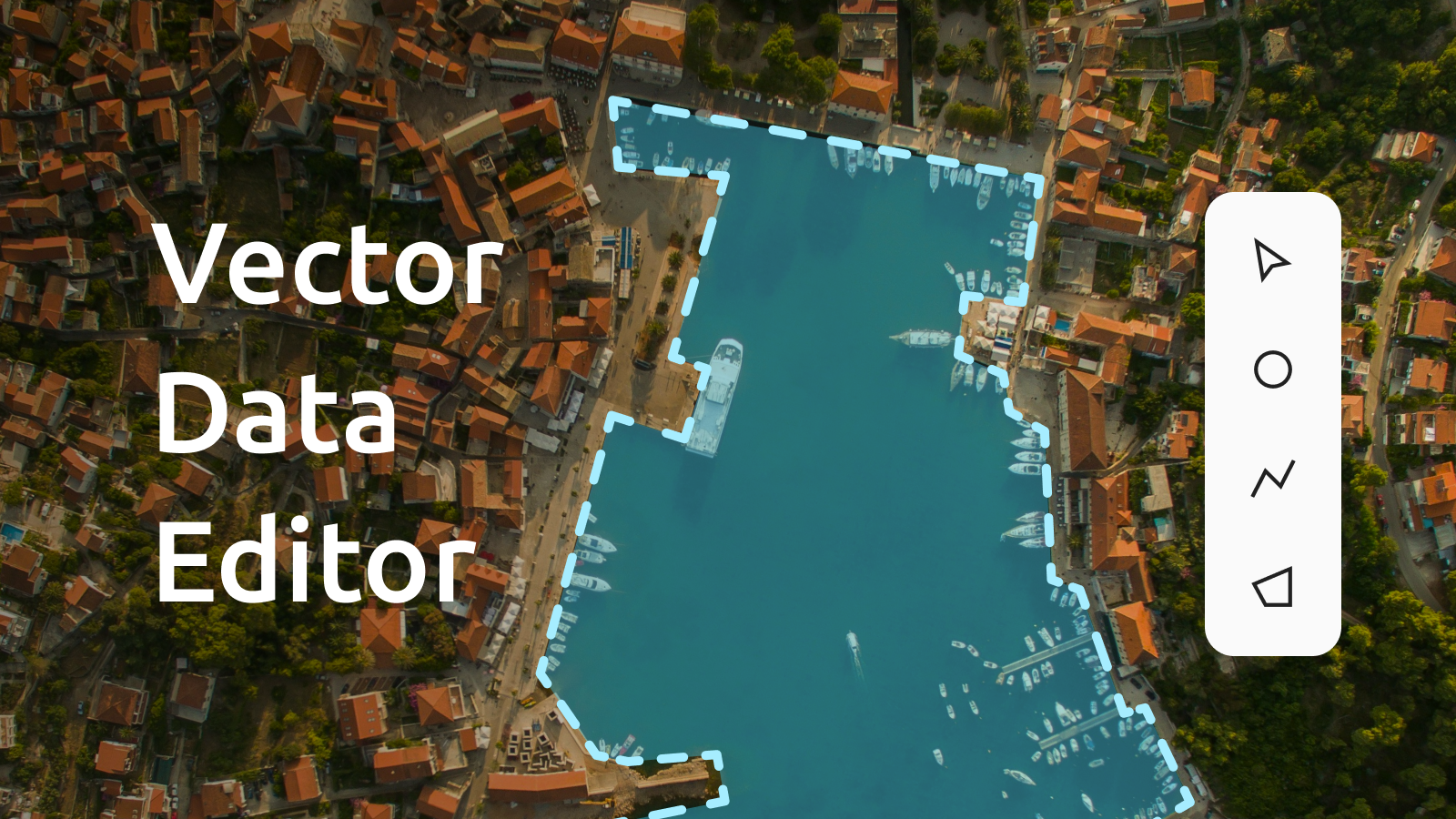
Digitizing satellite, aerial, and drone imagery
Load our high-res satellite map, upload your own aerial and drone imagery, or add your own map as an XYZ service.
Start creating points, lines, polygons, and add properties using a user-friendly web interface.
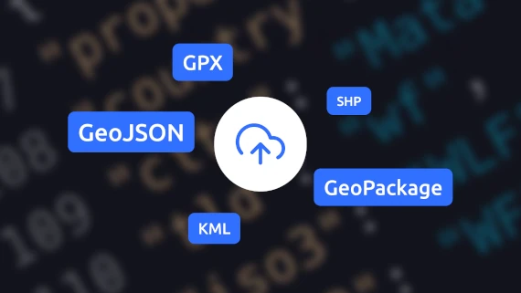
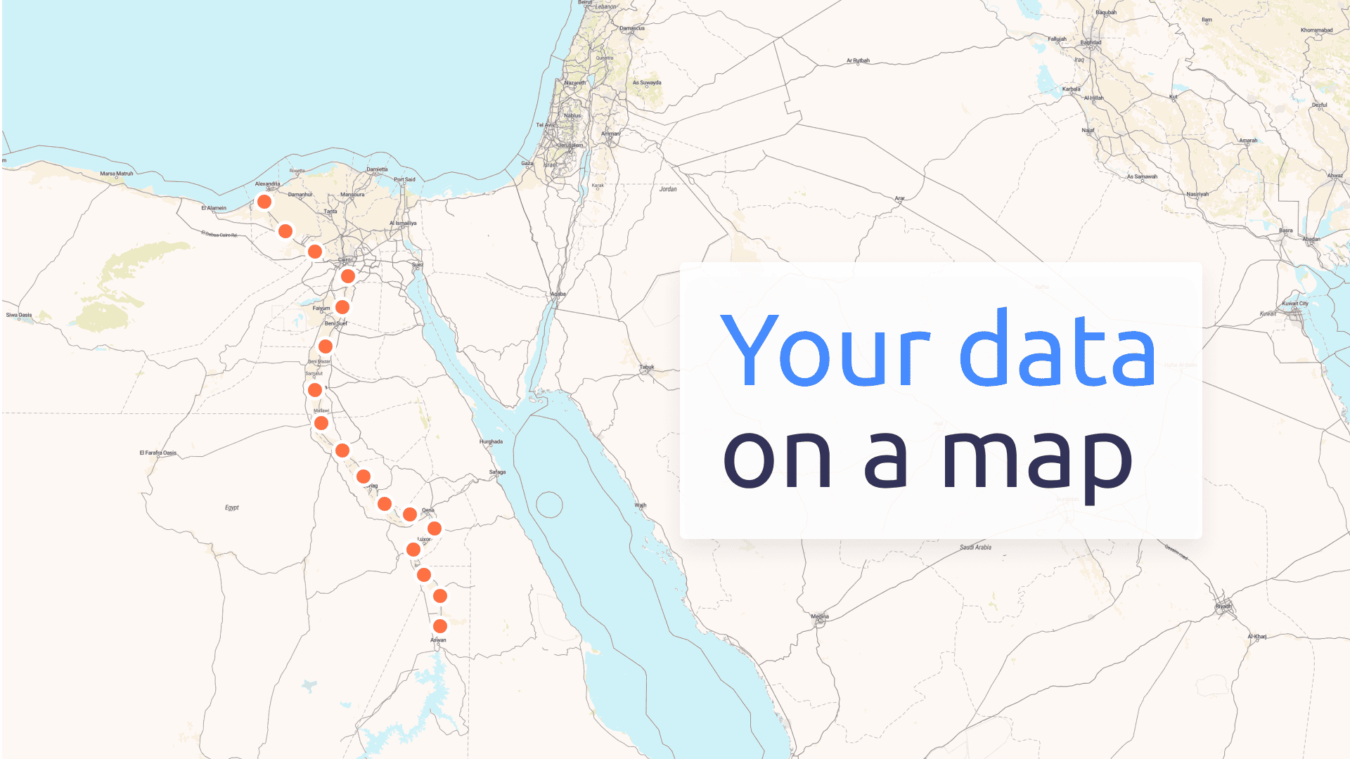
Import own data to location editor
Upload vector data to the reliable global infrastructure in .geojson, .gpkg, .gpx, .kml, or .shp as .zip format.
All original geometry and properties are preserved. Add locations and edit properties for each feature.
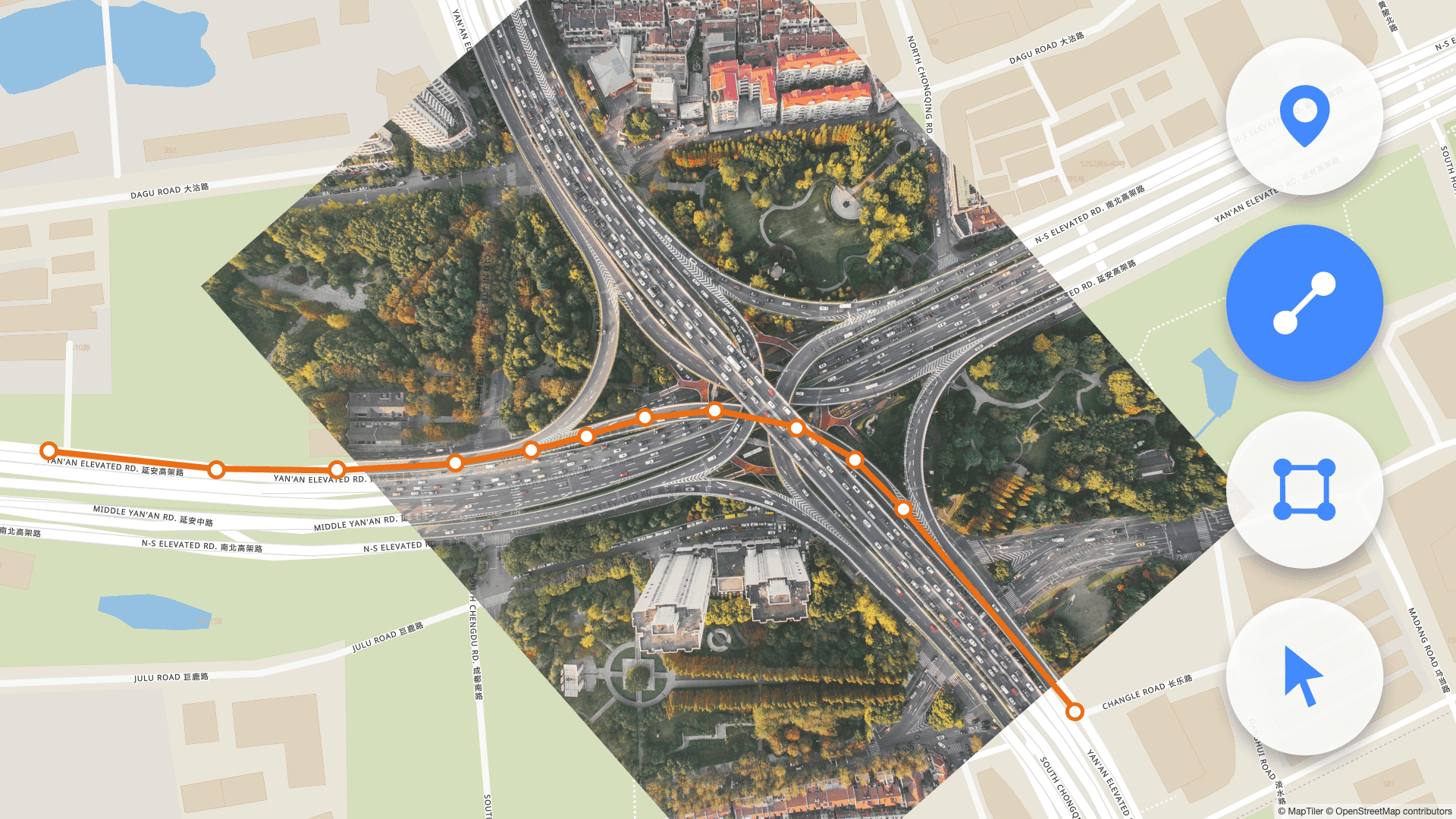
Search and Add geometry
Use the integrated geocoding service to search for locations like cities or countries and instantly add them to your map. With a single click, you can add entire geometries or just the center point.
Once added, the geometry can be further edited; explore options for snapping and dragging in the settings.
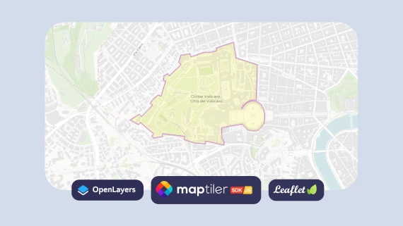
Design and publish maps online
Add data from Vector data editor into the Customize tool to change its appearance. Then, design your final map by overlaying your data on top of beautiful basemaps.
Once your map design is finished, get an API endpoint for use on the web with MapTiler SDK, OpenLayers, or Leaflet.
Download data for desktop GIS
Export your geometry as a GeoJSON file, ready for use in popular desktop GIS software such as ArcGIS or QGIS.


Read latest news about Vector data editor
Try Vector data editor now!
Use the tool for free as part of any Cloud plan.