Outdoor maps for all activities
Build a portal or mobile app for hikers, bikers, and other outdoor sports.
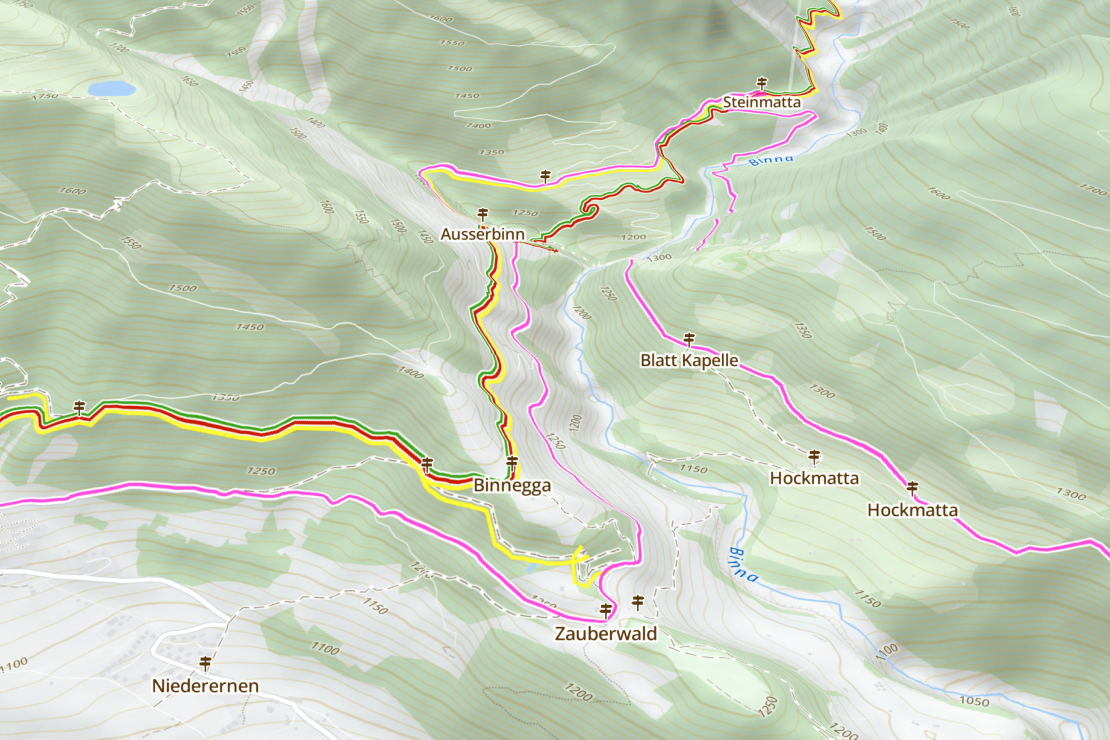
Hiking & Biking Trails
Routes are already marked on the map. Some are even graded for difficulty.
Points of Interest
Tourist attractions, accommodation, view points and more are all clearly shown on the maps.
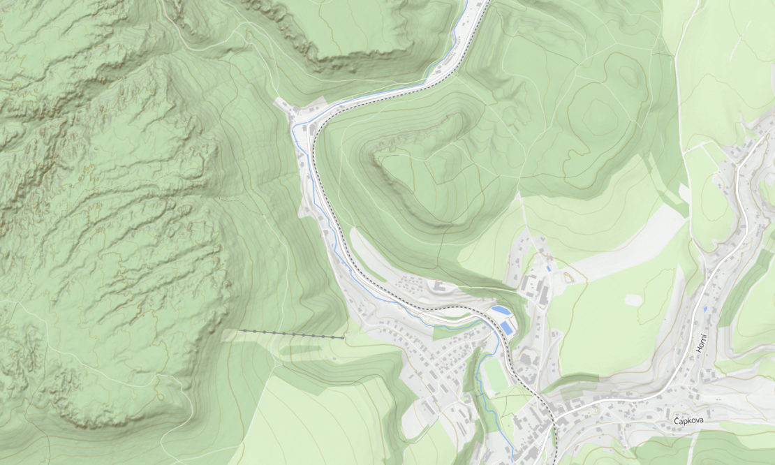
Terrain & Contours
Make better decisions about routes and equipment with the shape and steepness of the land on show.
Plan your next adventure
Whether you go for a round trip near your hometown or a long-distance trail throughout the country, MapTiler Outdoor guides you along selected routes and valuable points of interest.
The map highlights hiking trails over roads, natural phenomena over the cityscape, and points of interest like shelters, alpine huts, or springs over transportation infrastructure.
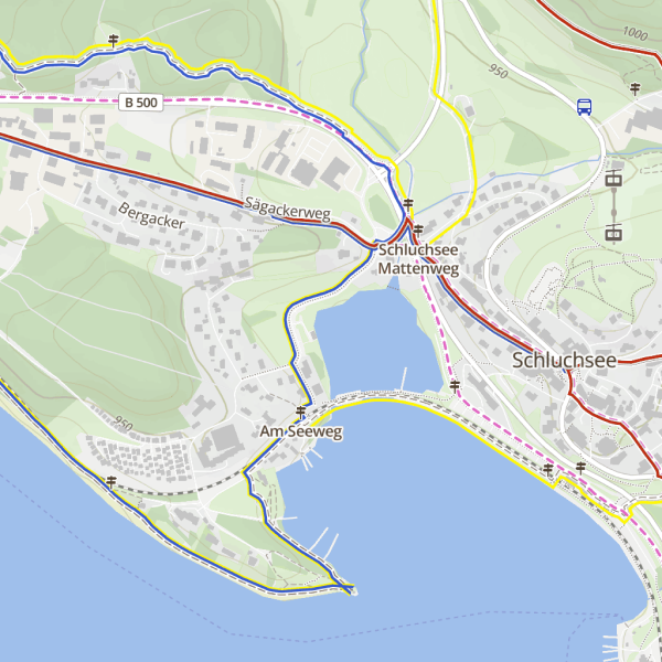
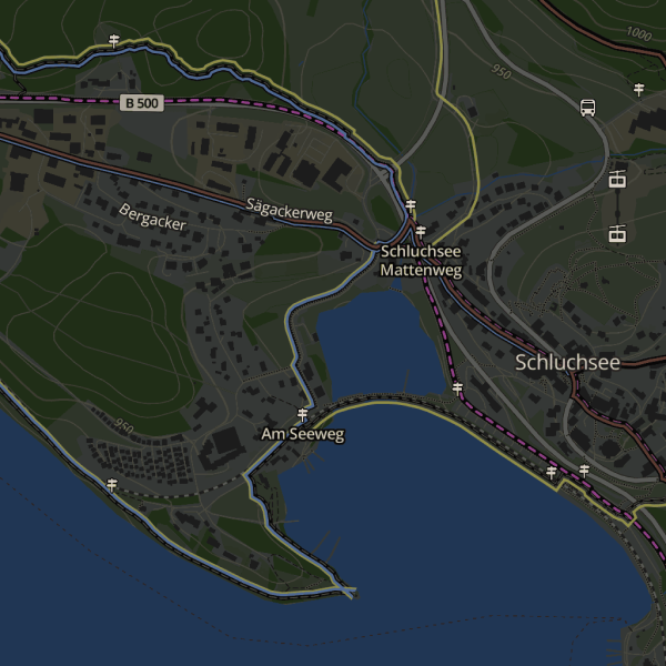
Dark and default maps for outdoor activities
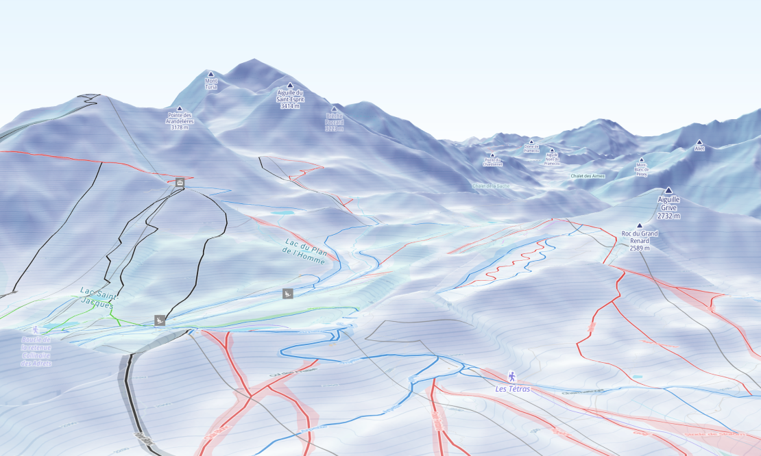
High-resolution terrain for maps
Enjoy more realistic 3D visualizations and precise profile measurements with the high-resolution terrain. It's available with a resolution of up to 5 meters in selected European countries.
We've even smoothed the transition at the borders by connecting and processing the different data sources together.
Winter maps
The Outdoor map pairs perfectly with the Winter map, designed for cold-season activities. Switch between them seamlessly depending on the season so your map stays relevant year-round.
Available as:


Start using Outdoor via Maps API
https://api.maptiler.com/maps/outdoor-v4/?key=YOUR-API-KEY