The latest version of MapTiler’s GeoSplats has 3 major upgrades:
- Terrain blending so you can merge your detailed 3D model into the underlying maps
- Faster processing times: up to 92% quicker
- Better camera control, including collision with the model
GET STARTED MORE ABOUT GEOSPLATS
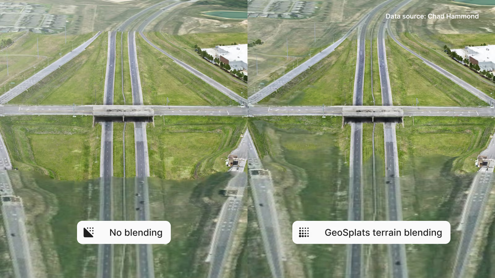
Blend your GeoSplats into the terrain
Terrain blending smoothly integrates photorealistic Gaussian splats into the digital elevation model (DEM) that gives the map its 3D surface. Blending GeoSplats eliminates sharp boundaries and clipping artifacts between the captured model and the map’s elevation surface.
The process starts with gravity estimation, which adjusts the model’s position so the base aligns more closely with the underlying DEM. After that, there are two parameters, intensity and smoothness, that can be used to merge the edges of the model into the map.
To try it out, you can use this example in the documentation: Blend splat models into 3D Terrain.
Process your GeoSplats up to 92% faster
GeoSplats have always run quickly in the browser, but they're now much faster to produce. This opens up more possibilities for using GeoSplats, such as creating daily updates for construction sites.
The latest update to MapTiler GeoSplats includes optimizations to the processing pipeline. The results were fantastic: the time to create a city-scale GeoSplat model (110 million splats) dropped from over 8 hours to 40 minutes!
Control how your users can view the model
Prevent users from zooming and panning through your model when the data has only been captured from the outside, ensuring a more natural viewing experience. You can now enable camera collision, preventing it from passing through the model when you zoom in too far. Instead, it collides with the model’s surface. Map navigation interactions, such as view rotation, remain centered on the model, resulting in smoother animations and more effective data visualization.
See the difference and learn how to enable or disable the camera collision mode.
The latest version of GeoSplats also allows you to set the initial position, bearing, pitch, and zoom when the model loads. This gives you full control of the scene as the model appears on your users' screens, letting you create visualizations with more impact.