Explore map catalog
Design and customize your own maps
Create powerful apps with our versatile SDK
Powerful map searching and geocoding services
Enrich maps with your own data
Secure self-hosted mapping solutions
Map styles for any use case
Follow Us
Published June 30th, 2026
Build interactive, photorealistic 3D world models by putting your splats on maps. Start georeferencing splats today.
Published June 17th, 2026
Place searching controls are available on all JavaScript maps, so there is no need to rely on Svelte anymore.
Published June 15th, 2026
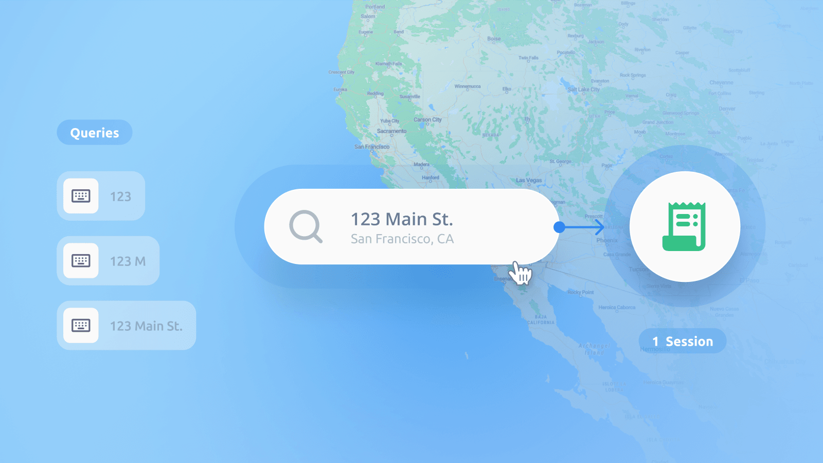
Geocoding Sessions to make sure your bills are more predictable, counting a user loading a map, exploring it, and searching for locations as a single action.
Published June 10th, 2026
Animated routes with dynamic cameras that follow a trail, flight, or road trip allow you to tell a story about where users are going and what they will see.
Published June 5th, 2026
Find out how to use the underlying logic of the geocoder and available parameters to fine-tune the search results for specific needs.
UpdatePublished May 20th, 2026
We have a new, clean, modern map of Japan that uses its specific cartographic conventions. Built with a unique blend of official GSI data and MapTiler’s premium Planet-V4 mapping dataset.
Published May 18th, 2026
MapTiler Server 4.8 has been released, allowing you to blend your own aerial or drone imagery into global satellite maps using a visual editor; deploy rapidly to Apple computers with the macOS Installer. Plus is has updated geocoding with world views.
UpdatePublished May 11th, 2026
A huge improvement to 3D models in our SDK enables great interactivity. We have a new, clean, modern map of Japan using their specific cartographic conventions.
Published April 15th, 2026
Version 3.16 offers improved road connections and dark-mode maps. Thanks to all the Open-source contributors who helped update it.
Published April 13th, 2026
Instantly transform raw images into fully georeferenced map tiles ready to publish with the new online georeferencer. Position floor plans, architectural drawings, and drone imagery using an intuitive web interface.
UpdatePublished April 1st, 2026
Create professional maps with gridlines, and a major update to our Satellite layer, adding up-to-date high-resolution imagery for Scandinavia and the US.
Published March 11th, 2026
Uncover the depths of 71% of Earth with our Ocean map, which visualizes the seafloor's richness by revealing ridges, basins, and trenches in stunning detail.