UPDATE: We have a new satellite map with an incredible resolution of 1-2m/px globally. Read more about it here: Global high-resolution satellite map.
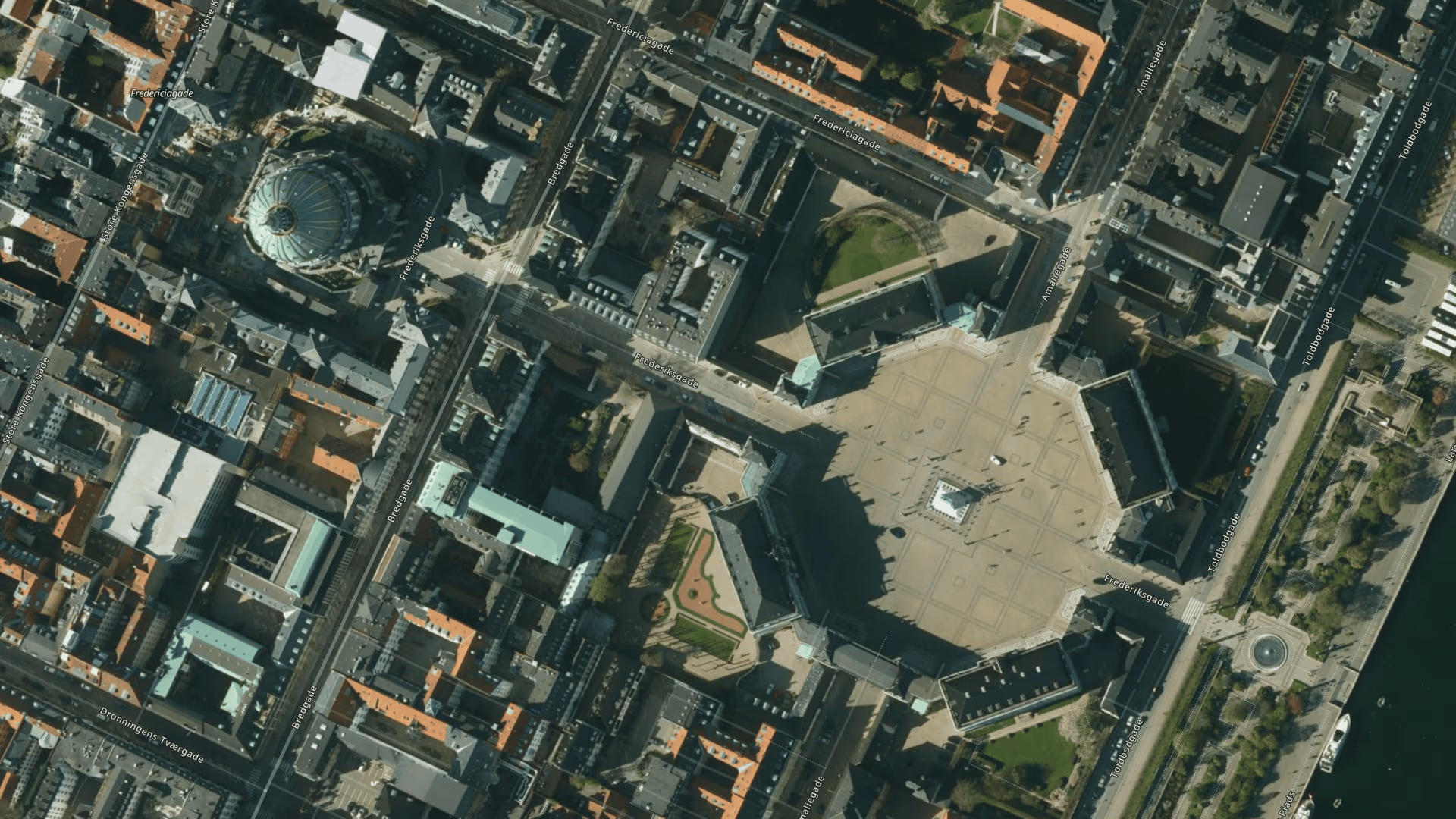
We just rolled out the first batch of high-res satellite imagery in our MapTiler Cloud map hosting. There is a 25 cm resolution available for the Netherlands and a 12.5 cm resolution for Denmark, and other areas will follow soon. They are seamlessly integrated into the current mid-resolution cloudless satellite layer with global coverage.
Zoom into the 12.5 cm resolution
The high-res aerial imagery is an addition to the current mid-res satellite imagery layer, which offers a cloudless satellite layer of the whole planet with a 20 m resolution. It was taken during the summer seasons on both poles to capture the vegetation peak.
Current high-res aerial imagery covers Denmark in the 12.5 cm resolution, the Netherlands in the 25 cm resolution, and a few other places like Zurich, Prague, Boston, or the San Francisco Bay area. Right now, we are working on the whole USA, and the rest of Western Europe will follow soon.
If you already have drone/aerial/satellite imagery, you can serve them from MapTiler Cloud. Alternatively, if you are a tech enthusiast, read about how to create your own satellite map from freely available sources. Foster City, California
Terrain with aerial images in 3D
We also combined the satellite layer with our terrain data and created a 3D model that can be used in your web applications with the open-source Cesium JavaScript library.
The satellite layer, as well as terrain, covers the whole globe so that you can browse the entire world in 3D. High-res aerial imagery combined with terrain data into the 3D model in MapTiler Cloud
Self-hosted or from fast, secure infrastructure
The mid-res imagery is available for download and self-hosting on your infrastructure or any other cloud service.
You can start using the high-res imagery from our fast, secure infrastructure with 99.9% uptime.
Browse the map and use it with popular JavaScript libraries (Leaflet, OpenLayers, MapBox GL JS or WebGL Earth), in mobile SDKs (for both Android and iOS), in desktop applications using QT or .NET or in desktop GIS software.