MapTiler increased the resolution of the satellite map of Europe with data from Airbus Defence and Space. You can now easily spot details like separate houses, cars on the street, or even individual trees, and even more in many countries!
Improved satellite map of the entire Europe
Many countries in Europe already have aerial imagery with a resolution of up to 12cm/pixel. The rest of the continent has a minimum resolution of 1.5m/pixel or 2.5/m pixel.
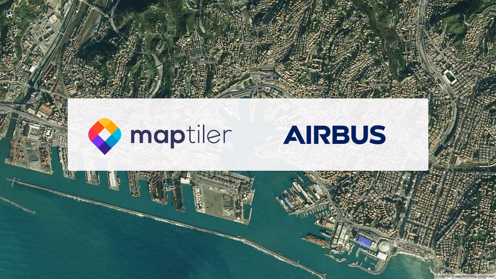
The data are supplied by Airbus Defence and Space, one of the divisions of the famous airplane manufacturer. This deal was possible thanks to our victory in Copernicus Masters. Those data were color-toned to fit with the rest of the satellite map in both higher and lower zooms.
Developers of web & mobile applications can use it via the Maps API, either standalone or with street/town labels or even with 3D terrain. It is the most affordable alternative to the Google Maps API, which respects privacy.
Even higher resolution from aerial imagery
We hope to increase further the resolution with data from the Airbus’ OneAtlas project, which offers even higher resolution and more up-to-date imagery.
In the meantime, we updated our medium-res satellite layer with imagery from 2018.
Now, we are enriching our map with high-resolution aerial imagery of individual countries/regions/cities. Some places, like Denmark, the Netherlands, Berlin, Prague, or the USA, already have resolutions up to 8cm/pixel, and we are working on others (e.g., France, Austria, Saxony region, …). Combine 3D terrain and high-res aerial imagery from MapTiler to create photorealistic scenes like this one
Imagery sources and resolutions
Data come from the Earth observation mission conducted by the SPOT 5 satellite (2.5m/px resolution) between 2006 and 2008, covering central and northern Europe. Newer data from SPOT 6 & SPOT 7 cover Mediterranean Sea countries (including France) and were collected between 2014 and 2016. All SPOT satellites are operated by Airbus DS.
The original raw data containing almost 10 terabytes of imagery was processed using our MapTiler Engine into the final zoomable map. MapTiler Satellite resolution per country, as of September 2019
Find more information, including details about the resolution of your country or subregion, at our Satellite map page.
Browse the satellite map at www.maptiler.com/maps/ and start using it from MapTiler Cloud via our Satellite Maps API.